How airlines plan for weather problems
Want to know what's happening with Typhoon Ragasa? Click here for live updates.
The warm, shallow waters of the sub-tropical West Pacific might be a draw for holidaymakers, but they’re also the base ingredients for a high-energy summer cocktail. Just add heat, sub-tropical humidity, a bit of convection and stir it up with drag of the Earth’s rotation and bang: a tropical storm. In the right circumstances, these can gain power and momentum as they track west towards Asia to create a typhoon.
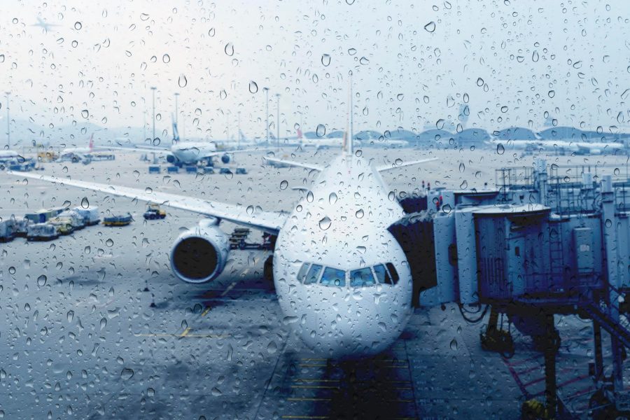
For Cathay Pacific, these weather events are part of the business of flying around Asia. The not uncommon instruction to return to your seats and buckle up are often a result of traversing Asia’s sometimes lively skies. A moderate inconvenience if you want a cup of tea or coffee (which can’t be served during turbulence), but everyday to the airlines’ highly trained pilots for whom – as with staff on the ground – safety is the first priority.
‘Our pilots go through a huge amount of training and this helps us handle the wide range of weather conditions that we can get around Hong Kong,’ says Captain Peter Clemmow, Cathay Pacific’s chief pilot (training).
A super-typhoon can cover many hundreds of square miles, but the effects locally can vary substantially. General manager of operations Mark Hoey says: ‘Sometimes we can operate a near-normal service in a typhoon but have to shut down in an ordinary summer storm because of the lightning – that alone can cause quite significant disruption.’
As anyone who has witnessed them can testify, Hong Kong storms offer a spectacular light show. But that’s also a safety concern. ‘When there is a red lightning warning, all ground staff have to go indoors,’ says Hoey. That means that all the people who service the plane, including loading, catering and fuelling, have to leave their posts – even if the weather looks calm.
He adds: ‘It means that incoming planes will have nowhere to go when they land because the bays are occupied with aircraft that can’t leave because they aren’t being serviced for departure. Yet it can be clear overhead. That can be difficult for people on planes that can’t get to a gate – quite reasonably – to understand.’
Once these suspensions start, the flying programme starts to back up. ‘It’s a domino effect,’ says Hoey. His team will already be working on not worsening the backlog of arrivals. Regional aircraft could be held at their departure airports, for instance, but that’s harder for long-haul services a day’s flying away. ‘The problem is that a lot of Cathay Pacific flights are ultra-long-haul, so we may have to land those aircraft short in Japan or South Korea,’ says Hoey. ‘Those passengers will face disruption because the crew will be out of hours, so they could be stuck for a day, but we do everything we can to look after them, but safety first – they wouldn’t appreciate being flown by exhausted crew.’
One of the safest places to be in an electrical storm is inside an aeroplane. Jim Ashby, a manager of line operations, says: ‘An aircraft acts like a Faraday cage, where the lightning passes through the aircraft structure then discharges safely into the atmosphere without affecting the occupants. Flying from Hong Kong, we can be more exposed to the possibility of lightning strikes than other carriers that don’t routinely operate in tropical regions. If your aircraft gets hit by lightning, you may see a flash, hear a bang or even detect a slight burning smell, but it’s perfectly safe.’
Lightning strikes tend to happen at lower altitudes when aircraft are taking off or landing, or while on the ground. When cruising, sophisticated weather radar and the trained eyes of pilots ensure that aircraft plot their way around the worst of the weather.
‘As pilots, we are committed to providing the safest and most comfortable travel experience for our passengers,’ says Ashby. ‘We use radar systems to identify potential weather issues, and carry extra fuel to allow us to divert around weather or hold until it has passed to give the smoothest flight possible.’
Safety is central to the decision making process. If the weather around the airport is too bad for aircraft to land, Hoey’s team and pilots will assess whether aircraft should wait for the worst of the conditions to pass or press on elsewhere. Hoey’s team will liaise with local airports – such as Shenzhen or Guangzhou – to ensure that parking bays are available for possible diversions. ‘It means we can land, refuel, restock and look after our passengers and then come back,’ he says. ‘But with some big weather events we will have to go further afield because these local airports could be affected by the same storm.’
Back on the ground in worsening conditions there are other issues to consider. ‘One of the big ones is “FOD” (foreign object debris),’ says Hoey. ‘These are items picked up and blown about by the wind – anything from tree branches or unsecured items from baggage bins to traffic cones, while really heavy rain can cause localised flooding on runways or taxiways.’
Aircraft themselves are used to strong winds – they fly at 600 miles per hour through the air – but they can be damaged by windborne objects. Hoey says: ‘In some cases we will load parked aircraft with extra fuel to help weigh them down. If we’re worried by damage from FOD, the next stage would be to secure as many aircraft as we can in hangars.’
In the very worst of circumstances, the decision may be taken to evacuate the fleet. ‘A few years ago, we had to do this and we flew all the aircraft we couldn’t fit into hangars to Clark in the Philippines,’ says Hoey. ‘It’s not a decision we take lightly and we’ve only come close to it once since.’
Obviously, after the schedule has been disrupted, there are passengers, planes and crew in the wrong place and not going to where they want to be, and it’s complex to rebuild the operation – but that’s another story.
Hong Kong’s typhoon flags
T1 – A tropical cyclone is within 800 kilometres of Hong Kong
T3 – Strong winds are expected or active in Hong Kong
T8 – Gale- or storm-force winds are expected or blowing. People are advised to make their way home and secure loose items. Public transport will stop within two hours of the flag being hoisted
T9 – Gale- or storm-force winds are increasing
T10 – Hurricane-force winds expected or blowing. Eye of typhoon may pass very close or directly over Hong Kong