Hong Kong's 7 wildest outdoor spots

Passengers flying into Hong Kong’s old Kai Tak airport used to see the roofs, washing lines and streets of eastern Kowloon (and often, TV screens inside flats – that’s how close to the city the landing was). That changed in 1998 when reclaimed land off Lantau Island became mega airport Chek Lap Kok. Then, arriving passengers landed to a different view, but one that’s no less Hong Kong: grass-covered hills of the territory’s largest island fading into the distance like those in a Chinese ink painting.
On closer scrutiny, these hills reveal they’re crisscrossed with fine lines – trails that follow ridges, contours and other folds in the land. On any weekend, they’re populated by hikers of all levels – lone, grim-faced trail-runners, groups of garrulous elderly people and tourists muttering over their GPS. Adding to their number are mountain bikers, with the occasional paraglider, dangling precariously from a day-glow sail, overhead.
Hong Kong’s country parks – all 24 of them – are popular. Last year, there were 13 million visits. The government has dedicated HK$660 million to their management and nature conservation. Yet the fact they exist at all is down to the efforts of what Stella Thrower called, in her book Hong Kong Country Parks, a ‘few clear-sighted men against a background of apathy and vested interest’. Those few men, in the 1960s and ’70s, saw a clear need for a recreational pressure valve to ease the tensions of those crammed into a city expanding with its rising economic clout.
They also identified a pressing need to conserve Hong Kong’s wildlife – some of it endemic – as urban areas encroached upon the countryside. Wildlife within the parks counts some surprising members – including king cobras, pythons, porcupines and wild boar – and the territory is crucial to the hundreds of thousands of migratory waterbirds travelling through each year.
Earlier reasons for preserving the vegetation hadn’t always been so high-minded: maintaining tree cover was seen as crucial for the protection of Hong Kong’s water catchment areas, vital for guaranteeing abundant supplies in case pumping water across long distances was not feasible. More recently, proposals for building new housing on the fringes of the country parks have provoked some heated discussion.
Whatever the reasons for the existence of Hong Kong’s country parks, they are glorious, and in many respects, world class. Take a late afternoon in mid-summer atop Wong Leng in Pat Sing Leng Country Park, when rainstorms have washed the skies, the light brilliant and crisp. To the east, the eight peaks (or fairies, as legend has it) of the Pat Sing Leng range descend to the still waters of Plover Cove Reservoir; to the distant north Shenzhen’s skyscrapers burn orange with the dying sun; to the west lie countless grass-covered hills and wooded valleys, punctuated by abandoned paddy fields and ghost villages. This isn’t unusual: this is what Hong Kong looks like. Go and see for yourself.
Credit: CP Lau
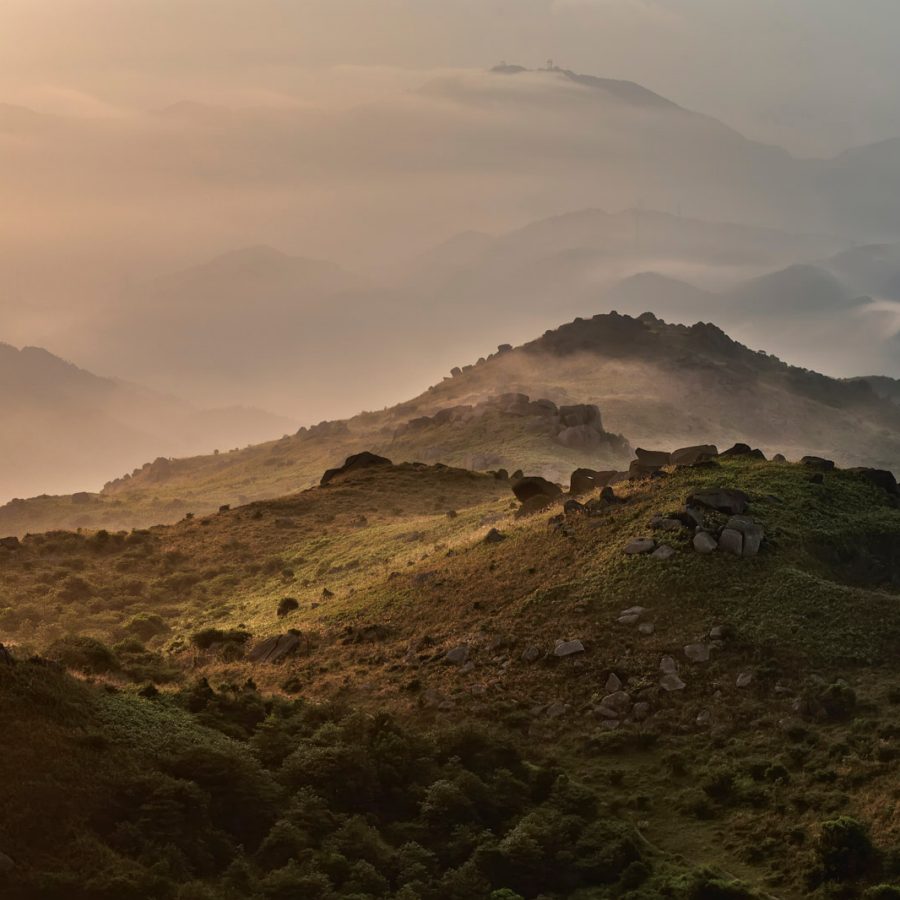
1. Tai Mo Shan, Tai Mo Shan Country Park
Hong Kong’s highest peak, at 957 metres, is topped by a collection of antenna and golf-ball radar stations. Abandoned tea terraces surround the peak, while the MacLehose Trail, which runs 100 kilometres east to west across the New Territories, passes by the summit. Nearby are the Ng Tung Chai Waterfalls – some of the most spectacular in Hong Kong.
How to get there: Bus 51 from Tsuen Wan MTR station, then walk up the MacLehose Trail
Credit: Luiz Antonio de Souza
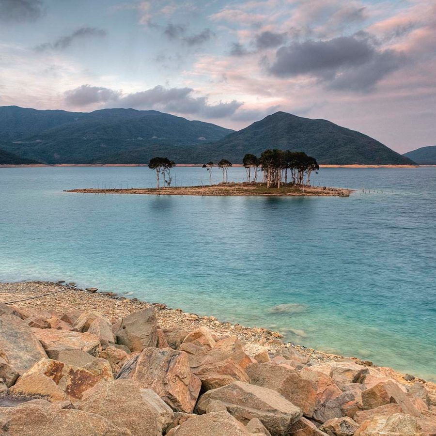
2. High Island Reservoir, Sai Kung East Country Park
This body of water was created in the 1970s when High Island was joined to the Sai Kung Peninsula by a series of dams – it takes the best part of a day to circumnavigate the reservoir.
How to get there: Walk in from Pak Tam Chung, or get a taxi from there or Sai Kung town to the East Dam
Credit: CP Lau
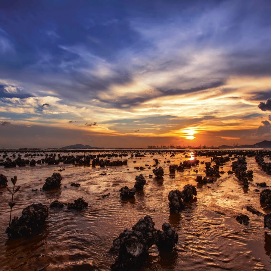
3. Ha Pak Nai
Popular with amateur photographers for sunset shots, this spot, though not in a country park, is a mangrove wetland area in Yuen Long, in the northwest New Territories, and is important for wildlife, particularly migrating birds. Nearby is Mai Po Nature Reserve.
How to get there: Minibus 33 from Yuen Long
Credit: CP Lau
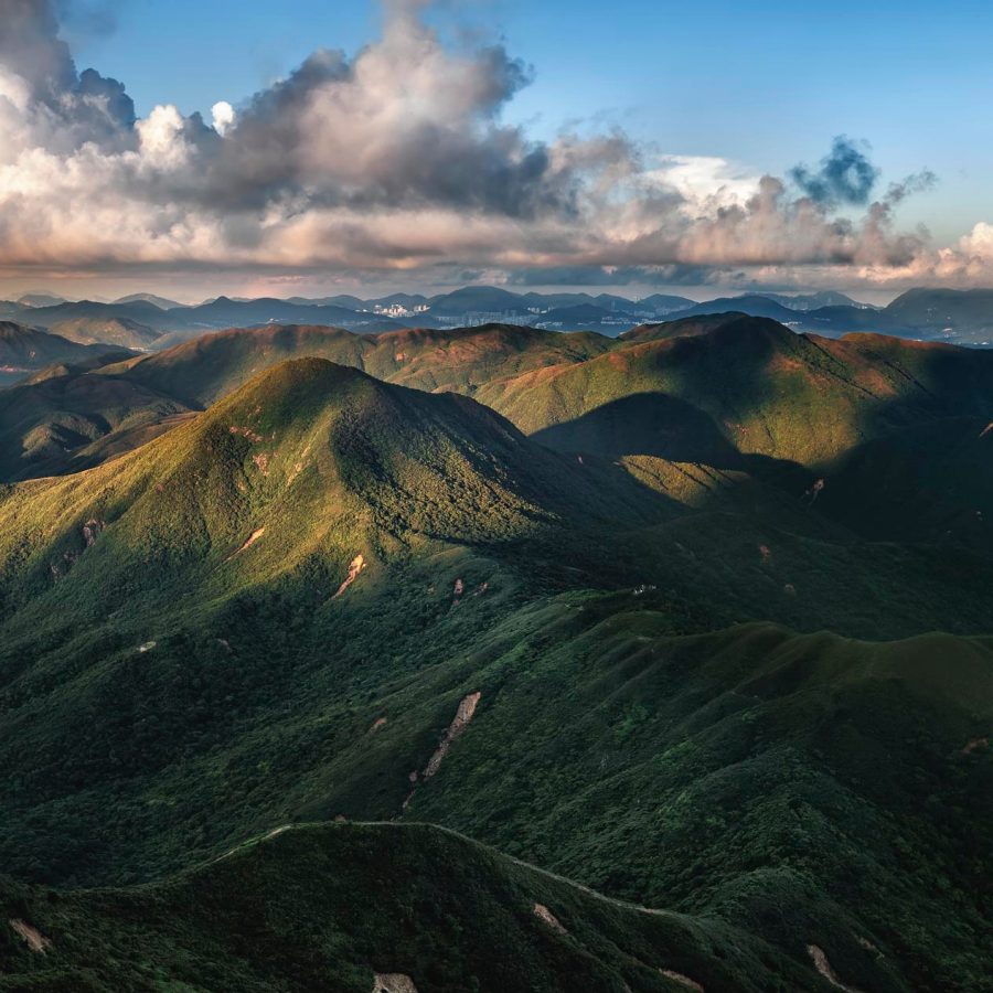
4. Sharp Peak, Sai Kung East Country Park
There are no peaks above 500 metres in either of Sai Kung’s country parks, but Sharp Peak, at 468 metres, is a tough climb with plenty of loose rock to make it a slippery undertaking. The views when you get there (pictured), though, make it all worthwhile. Hong Kong’s loveliest beach, Tai Wan, is below, while to the south are the scattered hills and islets of Sai Kung.
How to get there: Bus or minibus from Sai Kung town to Pak Tam Au, then head east on the MacLehose Trail
Credit: Marco Wong/Moment RF/Getty Images
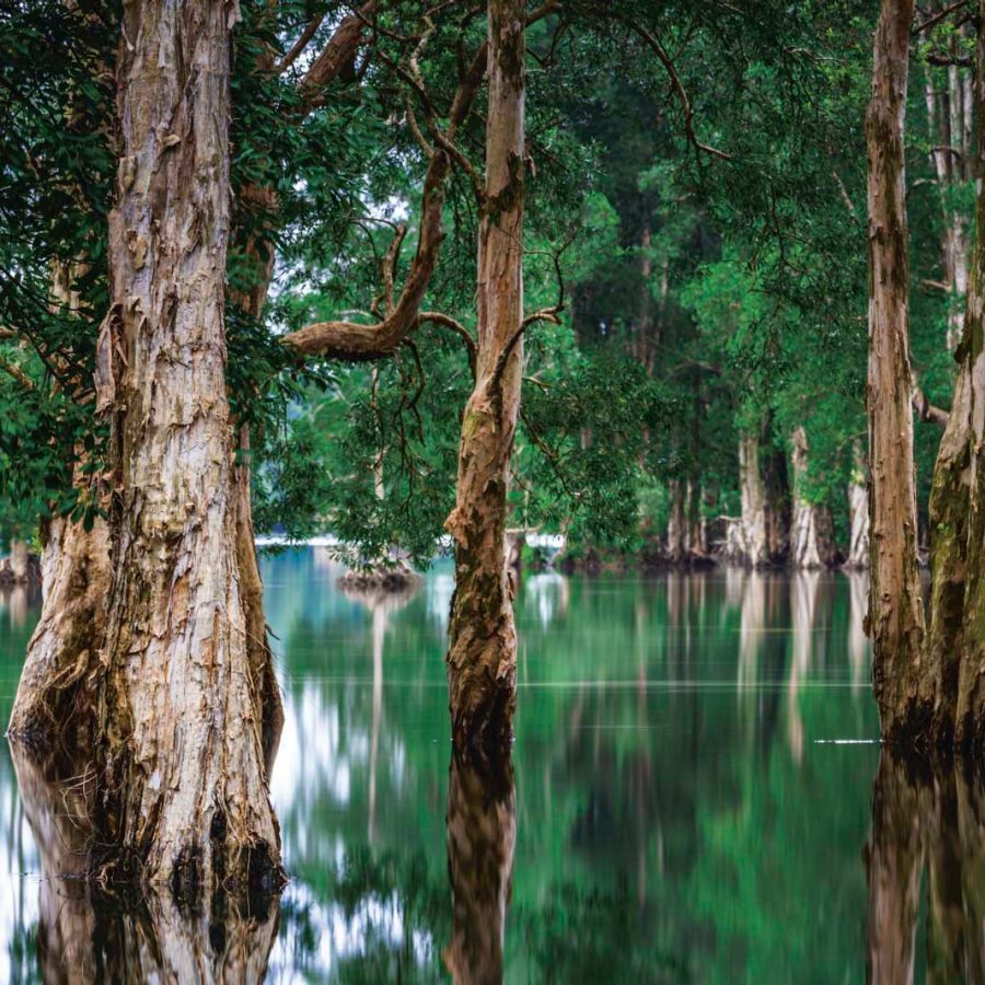
5. Shing Mun Reservoir, Shing Mun Country Park
This large reservoir set in a wooded valley is home to a substantial number of macaques: happy to relieve hikers of their picnics, but generally standoffish. The otherwise pleasant walk around it is some eight kilometres.
How to get there: Minibus 82 from Tsuen Wan
Credit: Luiz Antonio de Souza
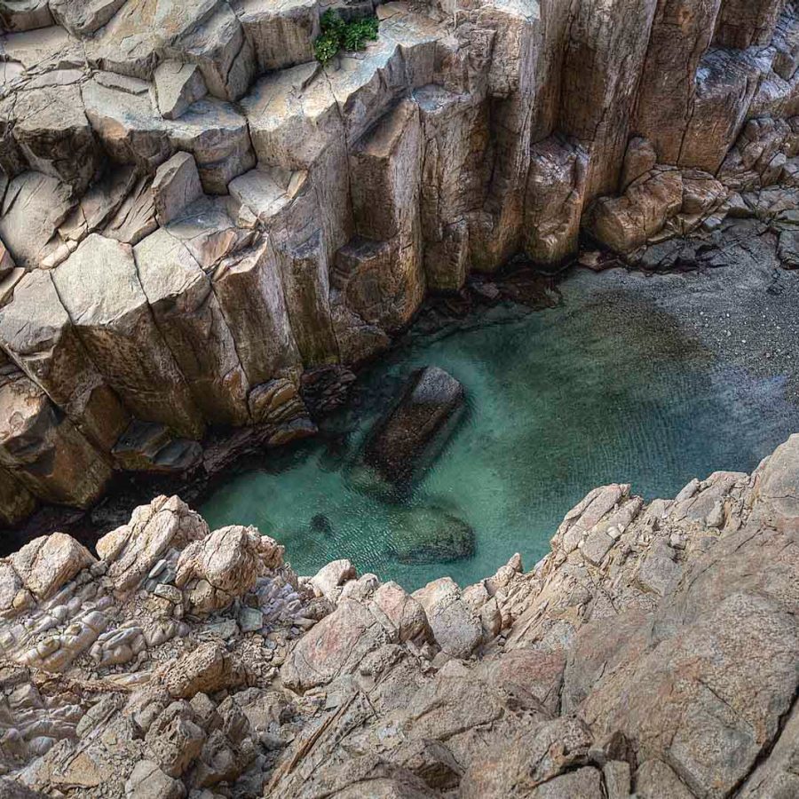
6. Ninepin Islands, Geopark
The Ninepin group of islands lie four kilometres to the east of Clearwater Bay, on Hong Kong’s marine boundary. Formed from columnar-jointed tuff (solidified volcanic ash to you and me), the area is part of the Hong Kong Unesco Global Geopark. The tuff forms an otherworldly collection of stacks, columns, arches and caves.
How to get there: Check the Geopark website for boat tours
Credit: Luiz Antonio de Souza
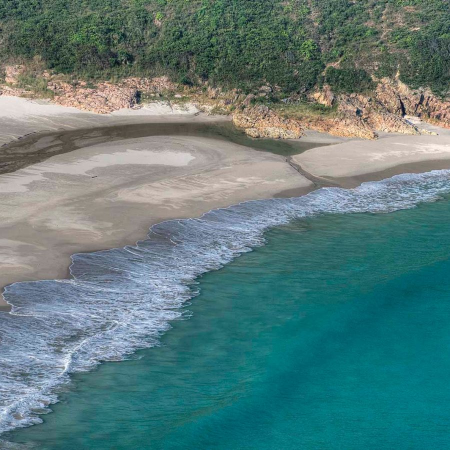
7. Long Ke Wan, Sai Kung East Country Park
One of many remote beaches in this area, Long Ke Wan is more easily reached than many, and has a campsite. Its clear waters and white sands are typical of this part of Hong Kong.
How to get there: Taxi from Sai Kung town or Pak Tam Chung to the East Dam of High Island Reservoir, then walk
More inspiration
Hong Kong travel information
- China – the Chinese Mainland, Hong Kong SAR, Macao SAR and Taiwan Region
- Hong Kong SAR - English
- Chinese Mainland (China) - English
- Taiwan, China - English
- 香港特別行政區 - 繁體中文
- 中国內地 - 简体中文
- 中國台灣 - 繁體中文
- Africa
- South Africa - English
- Asia
- Bangladesh - English
- Korea - English
- Singapore - English
- Cambodia - English
- 한국 - 한국어
- Sri Lanka - English
- India - English
- Malaysia - English
- Thailand - English
- Indonesia - English
- Maldives - English
- ประเทศไทย - ภาษาไทย
- Indonesia - Bahasa Indonesia
- Myanmar - English
- Vietnam - English
- Japan - English
- Nepal - English
- Việt Nam - tiếng Việt
- 日本 - 日本語
- Philippines - English
- Australasia
- Australia - English
- New Zealand - English