Exploring Hong Kong’s secret islands
More than 250 islands dot the waters around Hong Kong. Some, like Cheung Chau and Lamma, are home to lively communities, but there are many other outlying islands which count just a handful of residents (or none at all) and drift along in their own little time capsule.
A day or more spent on one of Hong Kong’s outlying islands is a mini-detox. It’s a chance to reconnect with nature, and a gentle, happy reminder that not so very long ago, outside the city centre, much of Hong Kong was similarly mellow and un-concreted.
Sailing to one of Hong Kong’s smaller isles is an adventure in itself, with fresh sea breezes, wide horizons, and majestic mountain views (the only high-rises around).

Credit: Elvis Chung
Credit: Elvis Chung
Credit: Elvis Chung
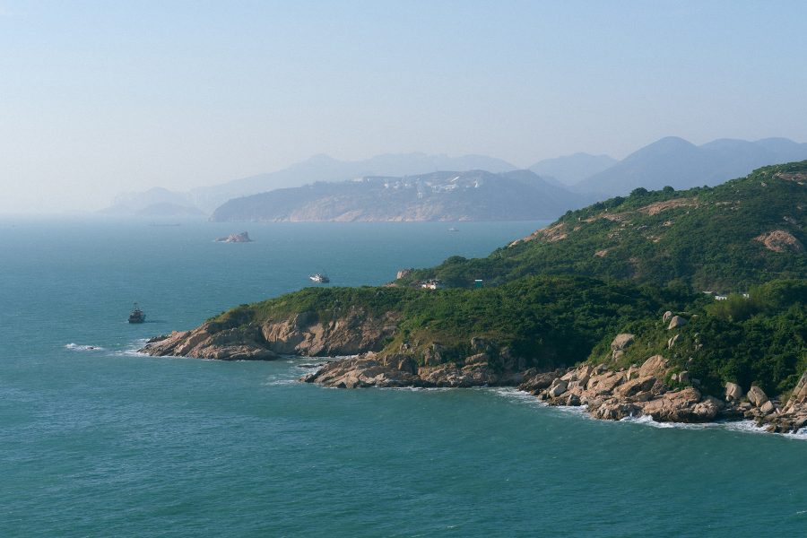
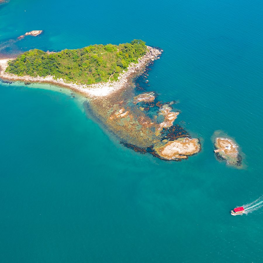
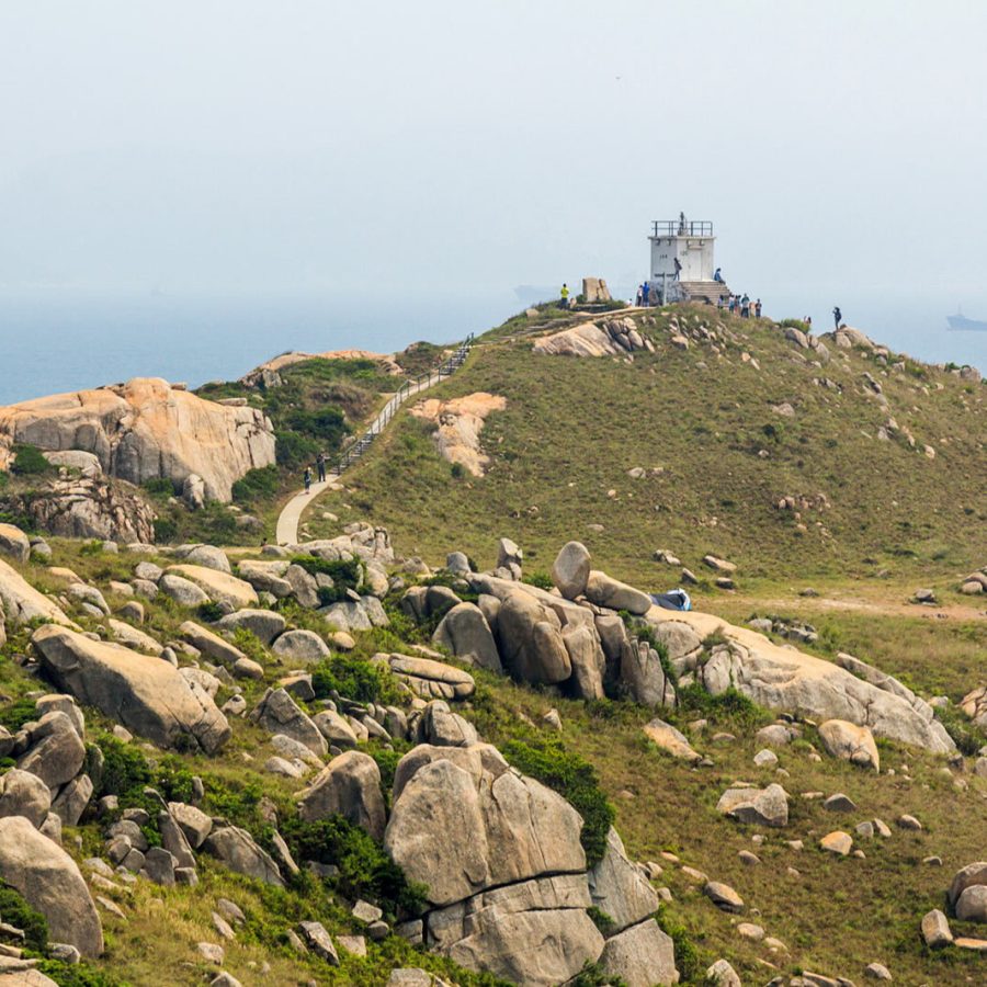
For hiking followed by a seafood lunch: Po Toi
Being the southernmost of Hong Kong’s outlying islands, Po Toi is jocularly referred to as the “South Pole of Hong Kong”. Over the years, wind, waves and tectonics have given Po Toi some amazing natural sculptures: check out the towering Monk Rock and its near neighbour, Tortoise Rock. Further on, five slender slabs etched into a cliff face look like the palm of Buddha.
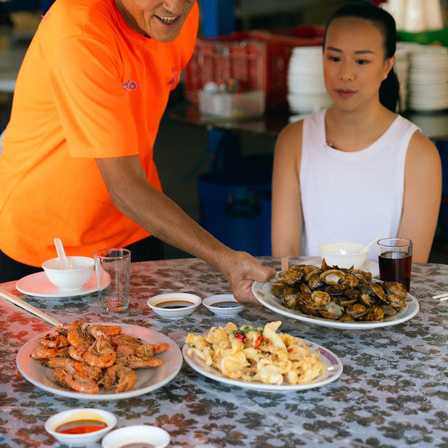
Po Toi’s location in the South China Sea makes it a prime source for tangy seaweed soup – a staple of most restaurant menus – while dried seaweed is the island’s bestselling souvenir. Round off your trip with a delicious lunch at the island’s famed restaurant, Ming Kee, which has been serving fresh seafood for more than 30 years.
How to get there: Kaito ferries sail from Aberdeen and Stanley’s Blake Pier; both take about 30 minutes. Check schedules here .
Credit: Martin Williams/Getty Images
Credit: Denise Lo/Getty Images
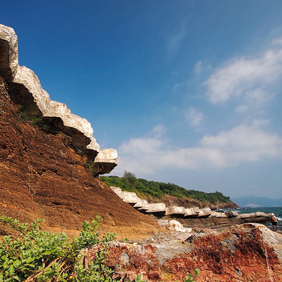
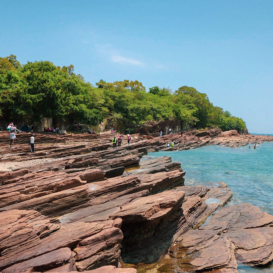
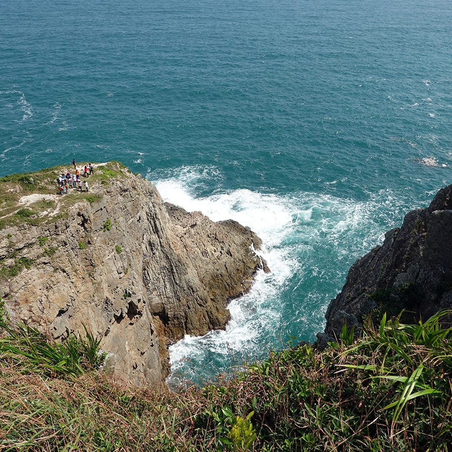
For a Unesco Global Geopark: Tung Ping Chau
In a word, Tung Ping Chau rocks. The fact that it’s part of a Unesco Global Geopark is almost beside the point – the outlying island’s weird and wonderful geology has been amazing people for thousands of years. A handy trail from the pier loops around the island, taking in wave-carved shale, cliffs stacked up like watch towers, a line of rocks that form a petrified dragon and a wondrous natural stone-lined corridor. Very few people live in the main village, Tai Tong, but they do pop back to sell food and cold drinks when visitor numbers are likely to be high. Take a picnic, just in case.
How to get there: Ferries sail from Ma Liu Shui Ferry Pier (a 15-minute walk or a short taxi from University MTR station Exit B) and take around 1.5 hours.

Credit: Hong Kong Tourism Board
Credit: Hong Kong Tourism Board
Credit: Hong Kong Tourism Board
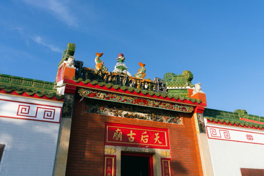
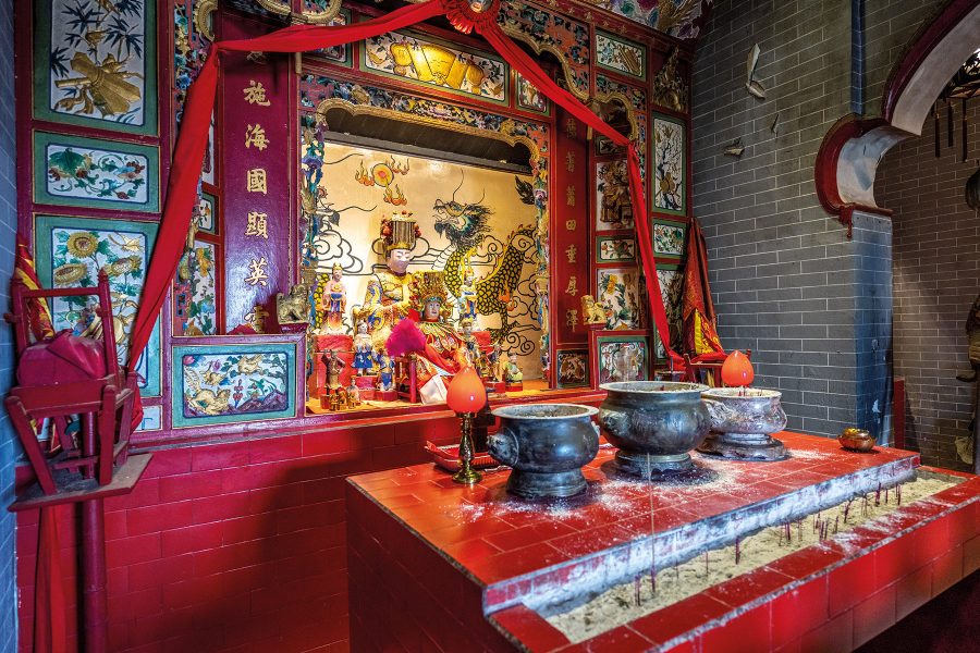
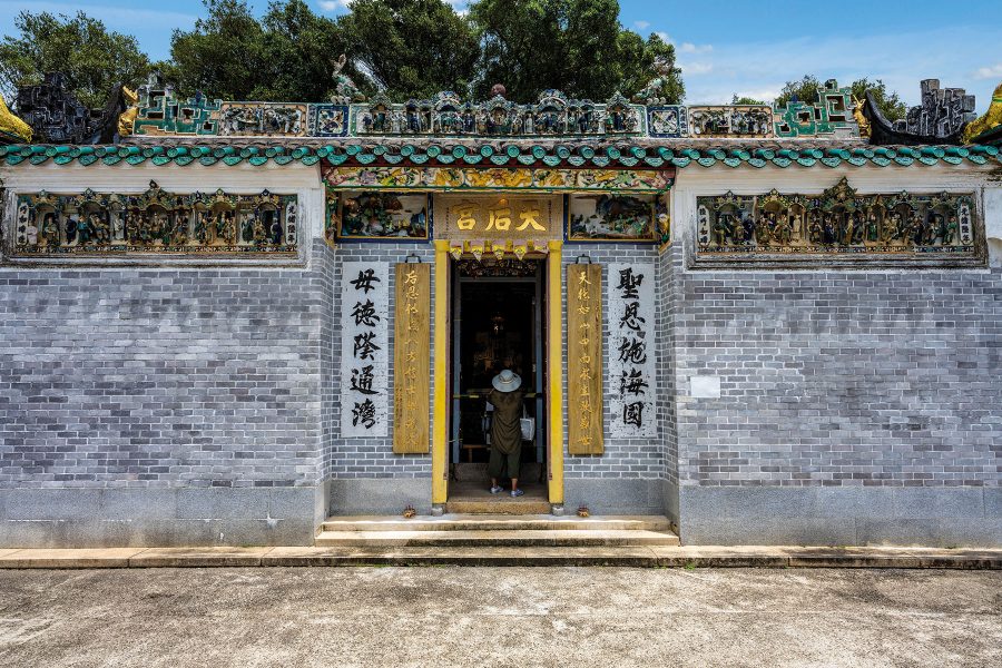
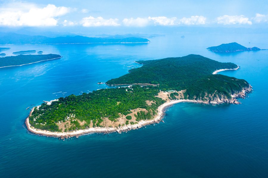
For a quiet oasis: Kat O
Don’t come to Kat O expecting bells and whistles, though there is an impressive 100-kilogram, 250-year-old brass bell outside the Tin Hau temple, inscribed with the words: “The country flourishes and the people live in peace”. This aphorism sums up the whole island, which is tucked away off the coast of the New Territory’s northeastern shores. Fewer than 50 people live here now, and it’s possible to wander Kat O’s lonely trails for quite some time and hardly see a soul. Young couples come to make wishes under the lovers’ tree in the main square of the village, and there are some inviting deserted beaches on the east side of the island. Three 19th-century cannons show up regularly in souvenir photos.
How to get there: Ferries sail from Ma Liu Shui Ferry Pier (a 15-minute walk or a short taxi from University MTR station Exit B) and take around 1.5 hours.
Credit: CHUNYIP WONG/Getty Images
Credit: CHUNYIP WONG/Getty Images
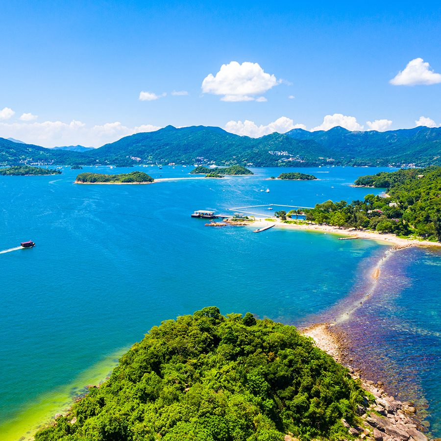
For beaches and volcanic rocks: Sharp Island
A lot of people get to one of the beaches – Hap Mun or Kiu Tsai – on Sharp Island and venture no further. Why should they? There’s golden sand, azure waters and plenty of space to kick back and relax. Laze if you want, but there’s a hiking trail that runs between the two strands, offering magnificent views over the sea and surrounding outlying islands that sprinkle the bay known as Port Shelter in Sai Kung. For an extra treat, hop over to Kiu Tau Chau, which is only accessible at low tide, when the water recedes to reveal clusters of volcanic rocks that look like pineapple buns.
How to get there: Catch a kaito ferry from Sai Kung Public Ferry Pier for the 15-minute journey to Sharp Island (or pay a bit more to hire a faster sampan). Ferries leave approximately every half hour, until 5:30pm (though frequency can vary between seasons or on weekdays and weekends).
Credit: SSS Sony/Getty Images
Credit: Lee Yiu Tung/Getty Images
For rock-climbing daredevils: Tung Lung Chau
Ask any sports climber in Hong Kong about their favourite pitches and they’ll almost always say “Tung Lung Chau”. Just off Hong Kong Island’s eastern coast, Tung Lung Chau obligingly furnishes no fewer than five named climbs, each with its own set of challenges and some spectacular urban and marine panoramas. Prefer to keep your feet on the ground? There’s a 300-year-old fort to explore as well as some ancient rock carvings. The island is also a popular camping site – in sight of the city, but well out of it. Just be sure to bring along your own provisions.
How to get there: Ferries runs from Sai Wan Ho typhoon shelter (a five-minute walk from Sai Wan Ho MTR station) on weekends and most public holidays, and from Sam Ka Tsuen Ferry Pier (a 10-minute walk from Yau Tong MTR station Exit A2).

Credit: gionnixxx/Getty Images
Credit: CHUNYIP WONG/Getty Images

Credit: CHUNYIP WONG/Getty Images
For solitude and exclusivity: Soko Islands
The Sokos – a mini archipelago well south of Lantau Island – are a walk on the wild side. Nobody’s lived on this cluster of outlying islands for half a century, and the only signs of human habitation are a few overgrown houses, shrines and the foundations of a long-abandoned refugee camp. So why come? The answer has to be solitude – and exclusivity. There are no ferry or kaito services; the only way to get here is by hiring a private charter, almost guaranteeing you an island to yourself. Back in 1980, a property development company planned to develop the Sokos into a resort – plans that anyone in search of complete peace and quiet will be glad to hear never got off the ground.
How to get there: Hire a private charter with a company like The Floatudio , which set sail from Cheung Chau. The journey takes about 1.5 hours each way.
Credit: Shutterstock
For camping and kite-flying: Tap Mun
Tap Mun is an unlikely place of pilgrimage. It’s more or less deserted year-round, with just a few score residents, several shops selling dried seafood and a restaurant that can safely bill itself as the best on the island. Yet once every 10 years, former residents flock from all over Hong Kong and around the world to celebrate this age-old fishing community at its Tin Hau temple. The celebration dates back to the late 18th century, when a storm ravaged a wedding held on Tap Mun and villagers prayed to Tin Hau, goddess of the sea, for protection. In honour of not losing their boats, livestock and loved ones, the villagers vowed to hold a celebration every decade – a promise still honoured two centuries later (the last one took place in April 2019). At just about any other time, visitors are free to explore, fly kites (there’s usually a stiff breeze blowing in from Mirs Bay) and even camp overnight on the green uplands that give Tap Mun its name: “Grass Island”.
How to get there: Kaito ferries sail from Wong Shek Pier (40-minute bus ride from Sai Kung town).
Before you go
As these islands lie on the fringes of Hong Kong, well away from mainstream transport, any excursion requires advanced planning. To be on the safe side, take water, some food and an extra layer in case the weather changes, and charge up your phone before leaving.
Small kaito ferries travel to and from many outlying islands, as noted above. The services favour weekends and public holidays, and while they’re inexpensive, the schedules can be infrequent; check the full list of timetables here .
This story was originally published in February 2020 and updated in March 2025.