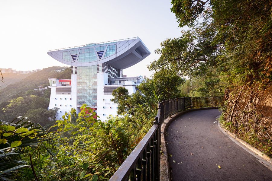
About 40 per cent of Hong Kong’s land is conserved within 24 country parks. This is not lost on the locals, many of whom spend their weekends hiking, at least in the cooler months. But visitors are often pleasantly surprised by the rugged mountains, gorgeous beaches and sub-tropical forest, full of thriving wildlife (some of it endemic) and 390 native tree species.
Even the remotest parts of the territory are within reach, thanks to the city’s efficient and inexpensive public transport system. Whether you’re a hiking novice, bringing the kids along or just pressed for time, these Hong Kong hikes provide an easy urban escape. Read on for details, along with some practical dos and don’ts.
Credit: Nikada/Getty Images
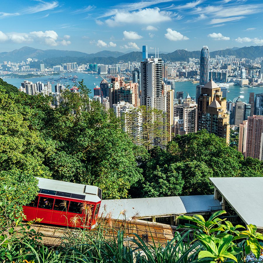
The Peak Circle Walk, Hong Kong Island
3.5 kilometres, 1.25 hours
A wonderful walk along Lugard and Harlech Roads that showcases the two sides of Hong Kong – urban core and mountains. Cars on these narrow paths are rare; the only drivers are the very few residents. The circuit starts and ends at the Peak Tram station and is a welcome respite from the crowds there. After a few hundred metres, the path opens up and provides jaw-dropping views of the skyscrapers of Central and Western districts, with Kowloon in the distance. Information boards scattered along the trail give clues about The Peak’s varied flora, such as camphor and scarlet sterculia trees.
Look out for: a magnificent India rubber tree, about halfway through the walk, with multiple stems and roots reaching across the path.
How to get there: Peak Tram or No 15 bus.
Credit: Thomas Au
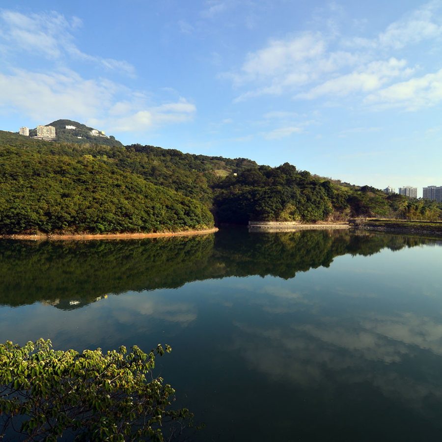
Pok Fu Lam Family Walk, Hong Kong Island
3.5 kilometres, 1 hour
Mountain tallow, schima and Hong Kong gordonia trees are notable examples of the rich biodiversity that has earned part of Pok Fu Lam Country Park the government designation, Site of Special Scientific Interest. This flat path loops through such woodland and follows the curve of Hong Kong’s first reservoir, opened here in 1863. It starts and finishes at the same point, unless you decide to continue to The Peak by following Pok Fu Lam Reservoir Road east and then north.
Look out for: the former watchman’s cottage at the beginning of the trail; views to the west towards Lamma Island from the higher sections of the trail.
How to get there: numerous buses go to Pok Fu Lam Reservoir Road, including the No 4 between Central and Wah Fu, and the No 71 from Central to Wong Chuk Hang.
Credit: Shutterstock
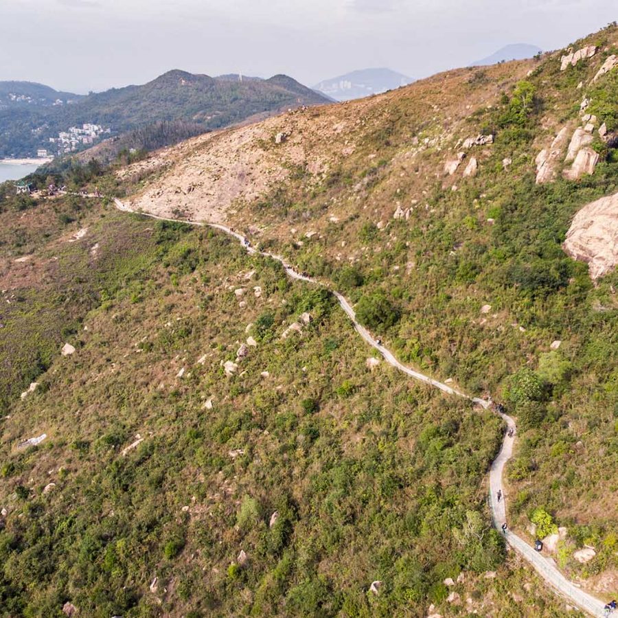
Dragon’s Back, Hong Kong Island
8.5 kilometres, 4 hours
Dragon’s Back is a classic among Hong Kong hikes. This charmingly named choice is admittedly not a secret, but merits inclusion as it is one of the best and most scenic hikes on Hong Kong Island. It’s not too challenging, with its highest point, Shek O Peak, at just 284 metres; and it’s refreshingly easy to access, meaning it’s likely to be the busiest of the suggestions in this list. However, start early in the morning and you can beat most of the crowds and be done in time for a well-earned lunch.
Dragon’s Back is so named for the ridge of mountains the trail follows at the eastern end of Hong Kong Island, with arresting views of the sea, city, mountains and the pleasant waterfront village of Shek O.
Look out for: the delightful beach at Big Wave Bay at the end, when you’ll be glad of a dip in the South China Sea (or a cold beer at the beach bar).
How to get there: MTR to Shau Kei Wan (25 minutes from Central), then the number 9 double-decker bus to To Tei Wan, where the trailhead is well signposted.

Credit: Stevecimages/iStockphoto/Getty Images
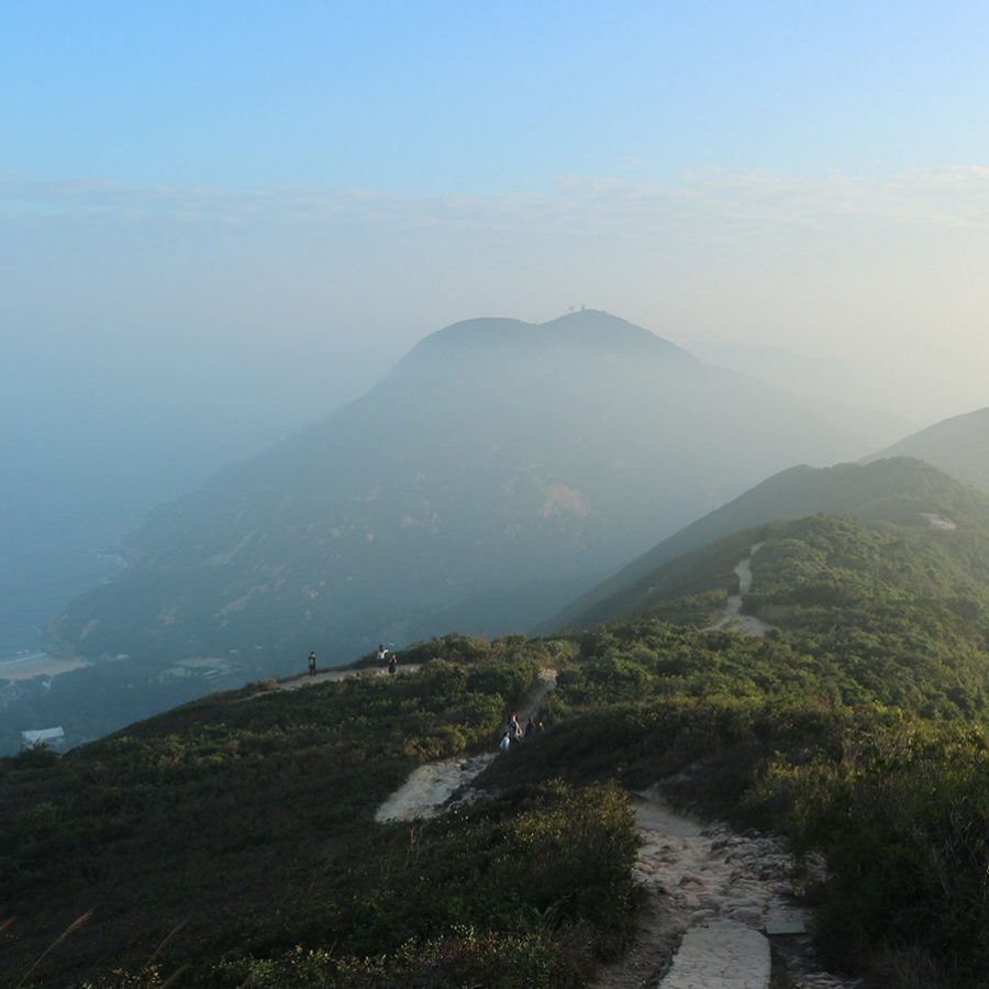
Shek Pik Country Trail, Lantau Island
6 kilometres, 2 hours
This enchanting walk takes you through a rugged part of Lantau, Hong Kong’s largest island, from its famous Big Buddha down to the south coast. The best approach is to take the scenic cable car up from Tung Chung. After paying your respects to the Big Buddha at Po Lin Monastery, breeze through kitschy Ngong Ping Village to reach the Wisdom Path. Its tree trunks are adorned with inscriptions calling for virtue. From here, the trail is clearly marked, and zig-zags down the western flanks of Lantau Peak, following the contours of steep ravines as you move from shrub-land in its upper reaches to scented pine forest lower down. The trail ends at the main Lantau catchwater; head west and down the road to the bus stop by the dam.
Look out for: sweeping views across the South China Sea; birds of prey over the peaks.
How to get there: MTR to Tung Chung Station/Ngong Ping 360 Cable Car. Buses operated by New Lantao Bus go from the reservoir to Tai O, Mui Wo, Tung Chung or back to Ngong Ping.
Lamma Island Family Trail
4 kilometres, 1.5 hours
Lamma Island features a series of gently undulating hills, one big one (Mount Stenhouse, 350 metres) and some truly lovely beaches. It’s also known for seafood restaurants and a boho atmosphere – both of which, we’re happy to report, are part of this section of the family trail. Take the 30-minute ferry ride from Central to Yung Shue Wan and head through the village on the path to Power Station Beach and from there on to Lo So Shing village. Soon after, the trail passes the "kamikaze caves", tunnels where the Japanese forces kept small suicide-mission boats during the Second World War. Continue around the coast to the many seafood restaurants of Sok Kwu Wan.
Look out for: the chance for a quiet swim at Lo So Shing Beach, just to the west of this trail; on weekdays, you may have it all to yourself.
How to get there: ferry from Central Pier 4.
CreditL Shutterstock
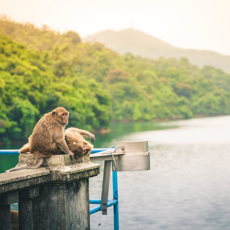
Kam Shan Family Walk, New Territories
1km, half an hour or more
Kam Shan is known as Monkey Mountain for good reason: most of Hong Kong’s 2,000 or so primates live here. Though they are generally benign, don’t be tempted to feed them. From the Shek Lei Pui Reservoir bus stop on the Tai Po Road, walk over the dam, continue for half a kilometre and set out on the Kam Shan Family Walk . The official walk is brief – it loops back along Golden Hill Road – but there are plenty of options to extend it. For instance, you could continue along the well-marked MacLehose Trail to the dam of Shing Mun Reservoir and back, an additional four kilometres.
Look out for: among the many rhesus macaques are another species – long-tailed macaques (the clue’s in the name). Also look out for turtles in the reservoirs.
How to get there: No 72 bus (Cheung Sha Wan to Tai Wo) or No 81 (Jordan to Sha Tin).
Credit: Marc Anderson/Alamy Stock Photo/Argusphoto
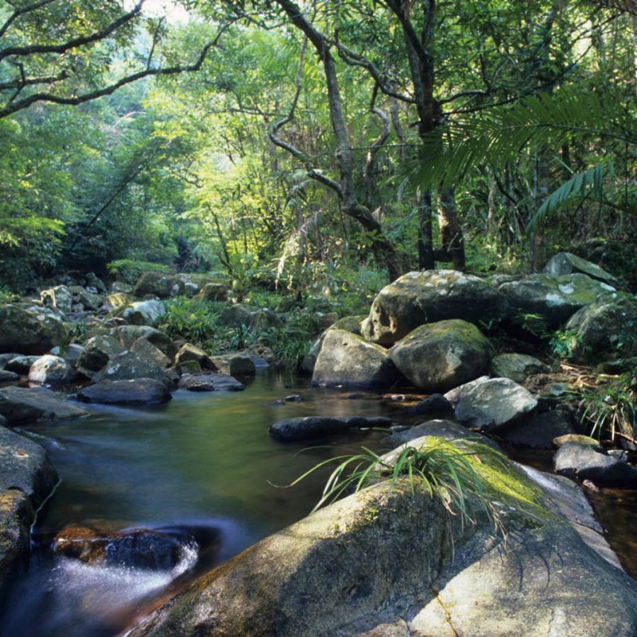
Tai Po Kau Nature Reserve, New Territories
4 kilometres, 1.5 hours
There’s a good reason that this is a popular area for birdwatchers and nature lovers: the 460-hectare sub-tropical forest is home to 100 different species of trees, which support a diverse array of wildlife such as spotted doves and the Chinese bulbul. There are four colour-coded trails cutting through tranquil, shady woodlands and past streams and pools. The blue trail is four kilometres long and goes through a lush part of the forest, much of the path adjacent to a stream, where you’re likely to spy lots of woodland critters. The red path is slightly shorter at three kilometres.
Look out for: birdlife – scarlet minivets are particularly striking.
How to get there: bus No 72A from Tai Wai MTR Station. Get off at the Chung Tsai Yuen stop.
Hiking dos and don’ts
- Pack snacks and plenty of water, no matter the time of year
- Bring one of the excellent Countryside Series maps – available from bookshops or the North Point Government Offices
- Bring a phone, but bear in mind not all areas have coverage
- Consider downloading the Enjoy Hiking mobile app (created by the Agriculture, Fisheries and Conservation Dept) and the Hiking Trail HK app
- Hiking with a companion is safest; if you do hike alone, tell someone exactly where you’re going and don’t forget to tell them when you finished
- Take a small torch in case you’re out after dark
- Be prepared to bring your litter home with you. Most trails do not have litter bins
- Don’t damage or pick plants, and don’t approach wild animals
- If a trail-running race is taking place, stand aside and let runners past
- October to March are best months for hiking, but the air quality is actually better during the summer. Short hikes can be attempted in the summer as long as you bring a lot of water and avoid the hottest part of the day (noon to 3pm)
Find more hiking information at hiking.gov.hk .
This article was first published in February 2019 and updated in March 2026.