How do you fly around a 50,000-foot cloud?
It’s a familiar routine. The gentle chime, the illuminated sign, and the request to return to your seat and buckle up. Asian weather can be volatile, particularly in summer with the sun heating warm, shallow seas, incubating the seasonal typhoons – which can make the inflight experience bumpy.
While these storms can cause disruption on the ground, it’s possible to fly over or around them at cruising altitude with barely a tremor. There is, though, a meteorological phenomenon that’s both global and year-round, and which always requires some thought on the flight deck: the ITCZ – the Intertropical Convergence Zone.
This is a belt of low pressure that spans the globe near the equator where the trade winds of the northern and southern hemispheres meet. It varies in width, and moves following the sun over the year. In summer months it drifts closer to Hong Kong, buckling further north over land, which heats quicker than the sea.
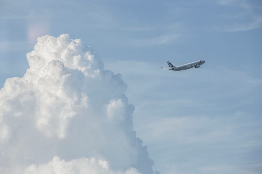
Glenn Devonport is a line operations manager and captain on an Airbus A350, with plenty of experience in avoiding the worst of the weather. The convective activity created by the heating of the sea and land creates lots of energy, says Glenn, ‘and that creates these bubbly clouds with large volumes of water, energy and turbulence. These are quite well separated, with one storm cell at a reasonable distance from the next, so we use radar to get around them.’
The ITCZ is slightly different, though. Glenn says: ‘Some of its cumulonimbus clouds can reach more than 50,000 feet. That’s higher than we fly and so you can spend hours dodging this weather, particularly south of Hong Kong.’
Pilots use whatever cues they can to plot the best route. ‘Primarily, that’s weather radar,’ says Glenn. ‘The radar beam reflects off the water particles in a cloud, forming the picture we see on our screen. The more water in a cloud, the more active it is, so this will go from green to yellow to red. The reflectivity of the radar can also track the vertical movement of the water droplets in a cloud. If droplets are moving up and down significantly, that will create a purple colour, which indicates very strong turbulence.
‘Often we have to pick a path with the least amount of rain or cloud, but we always make sure that it’s safe to do so.’
And only then does the chime sound and the seat belt sign come on.