Where to catch the best Hong Kong skyline views

No matter where you’ve travelled, you’d be hard pushed to find a more dramatic and architecturally diverse landscape than Hong Kong’s skyline.
It starts with the beguiling natural setting: Victoria Harbour and its churning waters, the soaring, lush mountains and the jaw-dropping sunsets. There’s the seemingly endless traffic on the water, the vapour trails in the sky and the remarkable impact of light – neon reflecting from advertising signs overlooking the harbour or over otherwise darkened streets and alleyways. Then factor in centuries of culture, with temples, homes and masses of humanity on the move.
Most of all, it’s the extraordinary variety and quantity of Hong Kong skyscrapers. The city ranks first in the world when it comes to the number of buildings over 150 metres high, with about 550 of them. From the distinctive portholes of Jardine House, which opened in Central in 1973, to the 484-metre-tall International Commerce Centre (ICC) that’s dominated the West Kowloon skyline since 2010, this is a city where the sky has never been the limit.
Here are some of our favourite Hong Kong skyline views and the best vantage points to see them.
Credit: SOPA Images/Getty Images

Credit: AsianDream/Getty Images
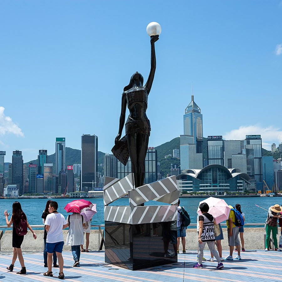
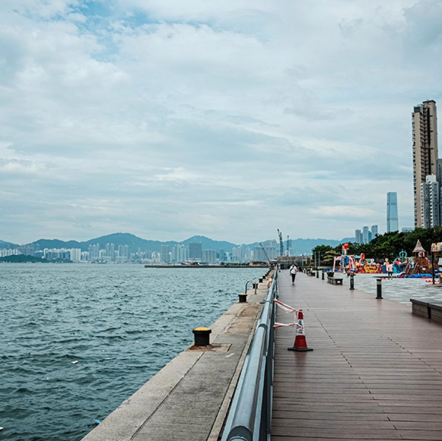
The view: Hong Kong Island
The vantage point: Tsim Sha Tsui Promenade
For the definitive picture-postcard – and indeed Instagram-worthy – view of Hong Kong Island, head to the Avenue of Stars on the waterfront promenade in Tsim Sha Tsui.
Your eyes will be drawn past the Star Ferry boats and junks plying the harbour up to the towering skyline of Central district. Countless skyscrapers including the International Finance Centre, HSBC Main Building and Bank of China Tower are backed by the green slopes of Victoria Peak. Surveying the scene, there’s a distinct and undeniable sense of the energy that defines the city.
How to get there: take the MTR to Tsim Sha Tsui, exit at C1 and walk down Nathan Road towards the waterfront. Alternatively, take the Star Ferry from Central to Tsim Sha Tsui and turn right off the ferry.
Credit: China News Service/Getty Images
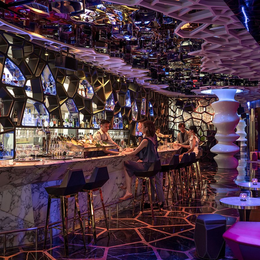
The view: Kowloon and Hong Kong Island
The vantage point: sky-high bars in Tsim Sha Tsui
More Hong Kong skyline vistas come from Tsim Sha Tsui’s high-rise bars. The highest is Ozone at The Ritz-Carlton, Hong Kong, situated 118 floors up and offering dizzying views across the South China Sea and over the Kowloon hills to the far reaches of the New Territories.
The city’s tallest retail complex, The One, features numerous bars with views taking in both Tsim Sha Tsui and Hong Kong Island: enjoy cocktails on Wooloomooloo Prime ’s open-air balcony for sunset or during the Symphony of Lights show at 8pm. Meanwhile, Aqua is a refined restaurant and bar on the 17th floor of H Zentre with sweeping floor-to-ceiling views of Hong Kong Island that are hard to beat.
How to get there: take the MTR to Tsim Sha Tsui. Some malls, and the rooftop bars within, can be accessed directly from the station, while other bars are a short walk away.
Credit: LeeYiuTung/Getty Images
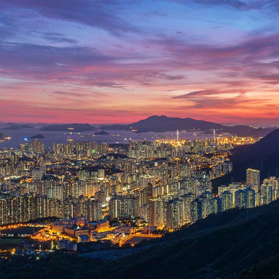
The view: Kowloon Housing Estates
The vantage point: Kowloon Peak
At 602 metres, Kowloon Peak, known in Cantonese as Fei Ngo Shan, sits within Ma On Shan Country Park in the northeast corner of Kowloon. It's by no means an easy feat to get to the summit, especially on sweltering summer days, but those who brave the hike are rewarded with spectacular vistas of the Kowloon peninsula. You’ll see chains of mountains, including Lion Rock, and even the distant fishing port of Sai Kung. Most, however, come for the views from the peak’s south face of the hundreds of housing estates that make up Kowloon.
How to get there: if you don’t mind a few hours of hiking, take the MTR to Choi Hung, Exit B, and walk along Clear Water Bay Road until you reach New Clear Water Bay Road. Head left on Fei Ngo Shan Road; Kowloon Peak is a further 30-minute walk. The quickest method is by taxi, which can drop you off on Fei Ngo Shan Road.
Credit: Sawayasu Tsuji/Getty Images
The view: Kennedy Town
The vantage point: Kennedy Town New Praya
Kennedy Town is a largely residential neighbourhood in the northwest of Hong Kong Island which doesn’t frequently feature on visitors’ itineraries. However, it has a growing food and drink scene – and affords some stunning views, especially at sunset. That’s thanks to its location strung along the waterfront, unimpeded by large buildings, meaning that the full extent of the setting sun can be appreciated in a panoramic, 180-degree view.
How to get there: take the MTR to Kennedy Town; leave the station through Exit C and walk towards the waterfront.
Credit: Nikada/Getty Images
Credit: ImpossiAble/Getty Images
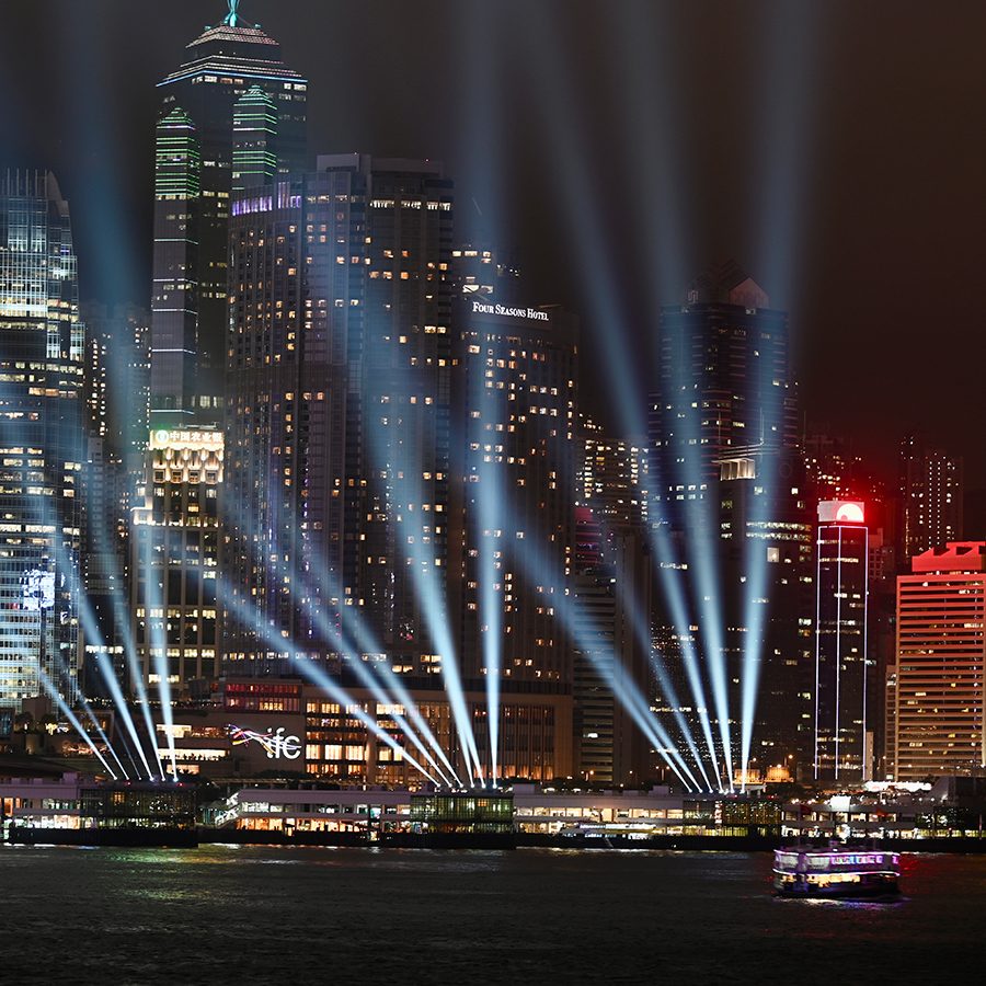
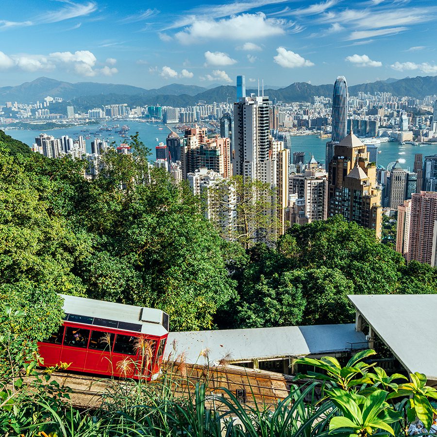
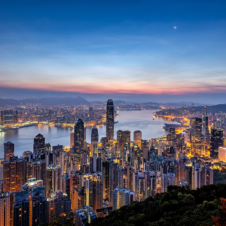
The view: Hong Kong skyscrapers from above
The vantage point: Victoria Peak
At more than 550 metres, Victoria Peak is the highest point on Hong Kong Island. The Peak , as it’s popularly known, can be reached on foot, by car or by riding the handsome Peak Tram. Whichever you choose, on a clear day – and particularly on a clear night – the Hong Kong skyline views are unbeatable. You have the spread of Hong Kong Island’s skyscrapers beneath you, as well as the harbour, Kowloon skyline and a great angle of the ICC, which puts on its own LED light shows to complement the constellation of twinkling skyscrapers.
How to get there: the most memorable experience is riding the 130-year-old Peak Tram from Admiralty, but several buses also run to The Peak. To get there on foot, hiking routes lead to The Peak from Central, Wan Chai, Pok Fu Lam and Aberdeen.
Credit: EarnestTse/Getty Images
Credit: leungchopan/Getty Images
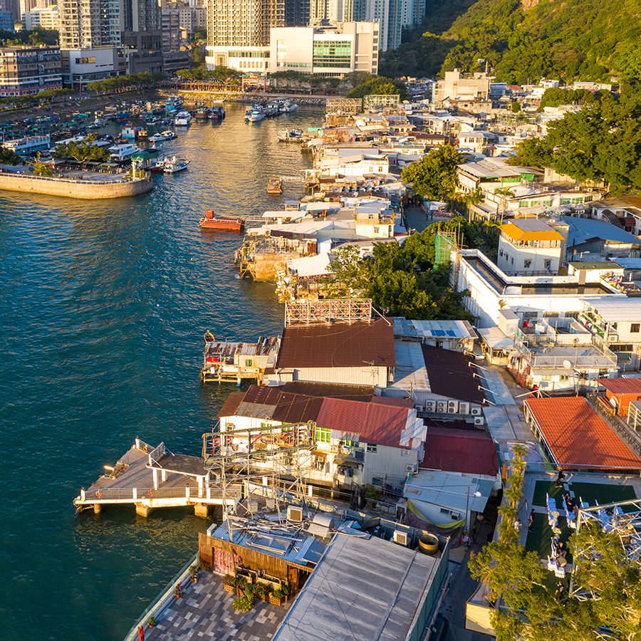
The view: Hong Kong from the east
The vantage point: Lei Yue Mun
Another spectacular sunset view is found at Kowloon’s Lei Yue Mun , a traditional fishing settlement which sits at the mouth of Victoria Harbour. The ramshackle nature of the village harks back to Hong Kong’s past, while its location right on the water gives it great views over the towering developments of Hong Kong Island’s eastern side, all the way up to the skyscrapers of Central in the distance.
Craft the perfect sunset shot from the village's numerous shoreline boulders before you head for dinner at one of the local restaurants – Lei Yue Mun is known for its seafood.
How to get there: from Hong Kong Island, take the MTR to Sai Wan Ho and catch the ferry to Sam Ka Tsuen. From Kowloon, take the MTR to Yau Tong and either walk or take a taxi or the number 24 green minibus.
Credit: Moy photograph/Getty Images
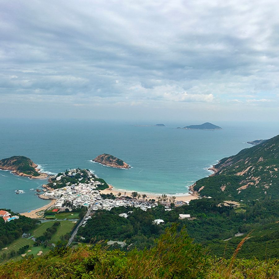
The view: Shek O
The vantage point: Dragon’s Back trail
For such a densely populated destination, many visitors are surprised by Hong Kong’s huge variety of trails, where hikers can often find themselves completely alone. The Dragon’s Back is a ridge in the southeast of Hong Kong Island, home to one of the more popular trails which boasts beautiful, sweeping views down towards the dreamy beachside village of Shek O and the dramatic coastline out to the South China Sea.
The meandering path offers numerous sightseeing opportunities, while those who finish the trail at Big Wave Bay tend to cool off by swimming or surfing the waters – and enjoying a cold beer or two.
How to get there: take the MTR to Shau Kei Wan, leave via Exit A for the bus terminus and take the number 9 double-decker bus. Get off at the To Tei Wan/Dragon’s Back stop, which is the trailhead for the roughly three-hour hike.
Credit: CHUNYIP WONG/Getty Images
Credit: Jina Ihm/Getty Images

Credit: Yoyochow23/Getty Images
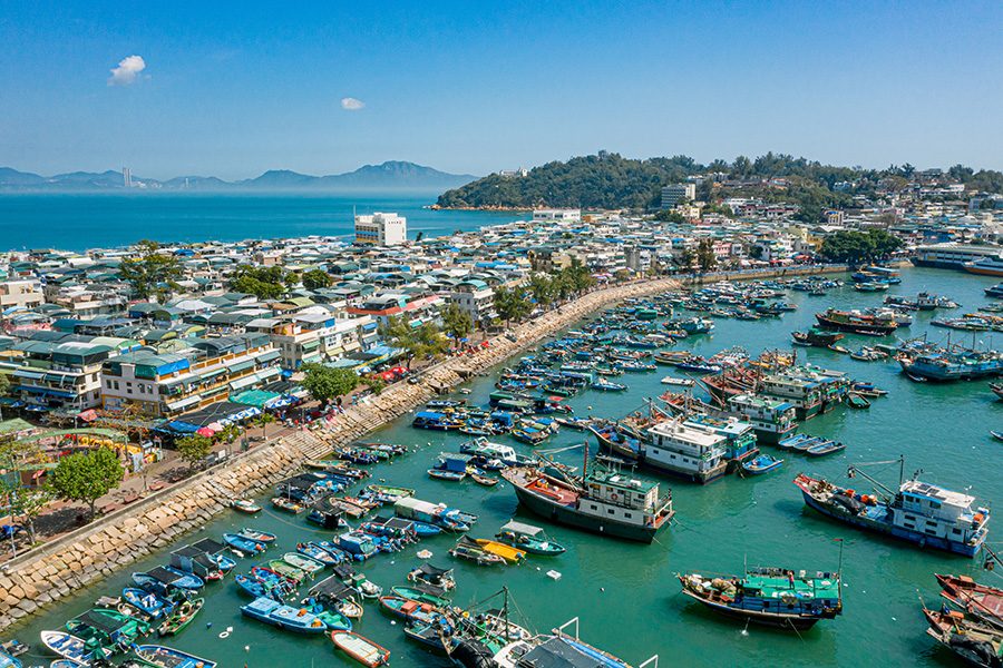
The view: Cheung Chau fishing boats
The vantage point: waterfront walk and restaurants
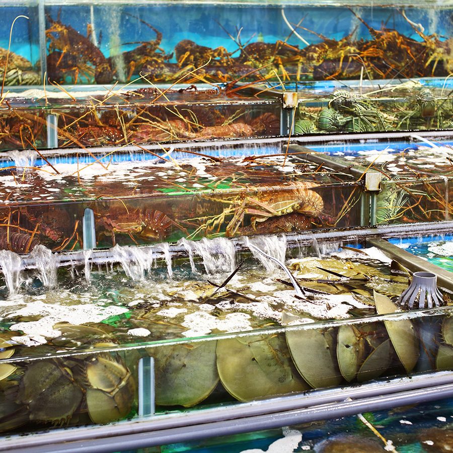
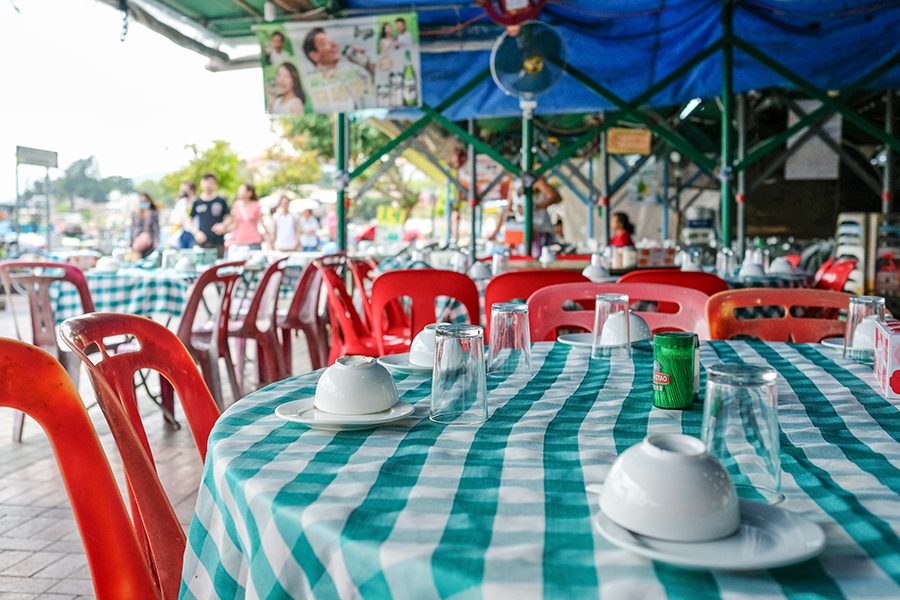
Another rewarding out-of-town destination is the fishing island of Cheung Chau, about a 35-minute ferry ride from Central. Temples, beaches, windsurfing spots, seafood restaurants and a former pirate’s hideout are just a few of the many draws of this sleepy, slow-paced island.
A winding shoreline walk brings you past local fishermen drying seafood in the sun, but it’s the views over their dozens of boats that provide a stunning photo op for amateur and professional photographers alike. Pair the idyllic views with a memorable meal at one of the waterfront seafood restaurants such as So Bor Kee .
How to get there: ferry from Central’s Pier 5, then turn left along the promenade after disembarking.
Credit: SSS Sony/Getty Images
Credit: South China Morning Post/Getty Images
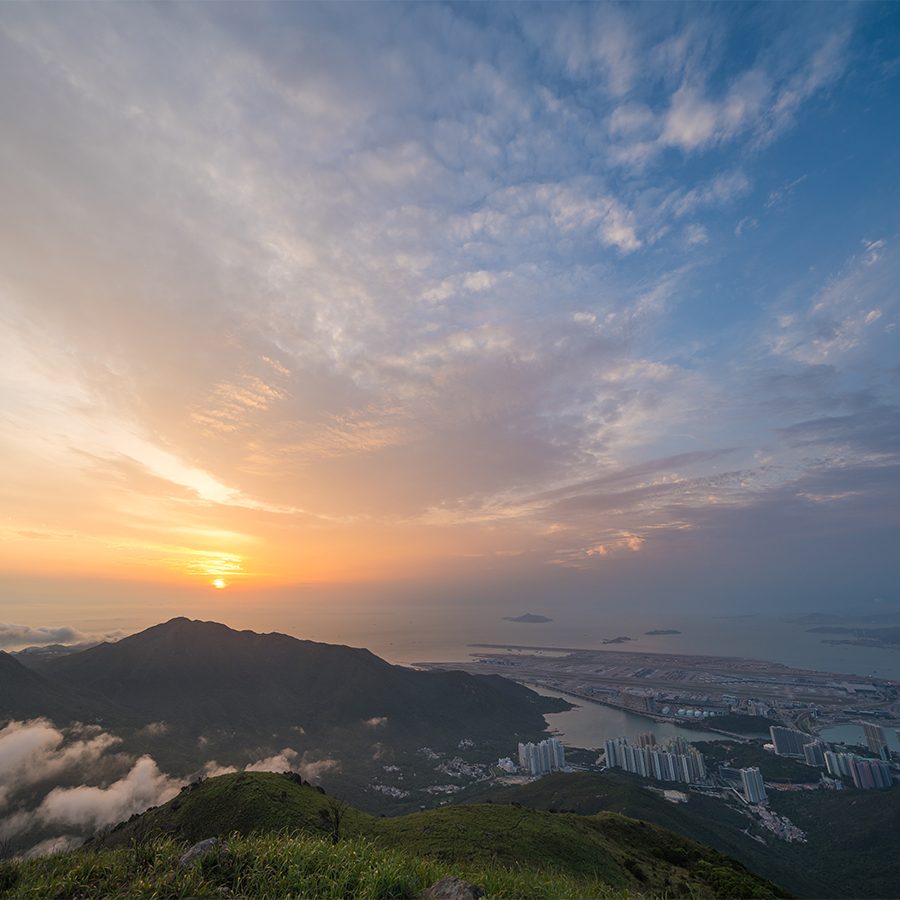
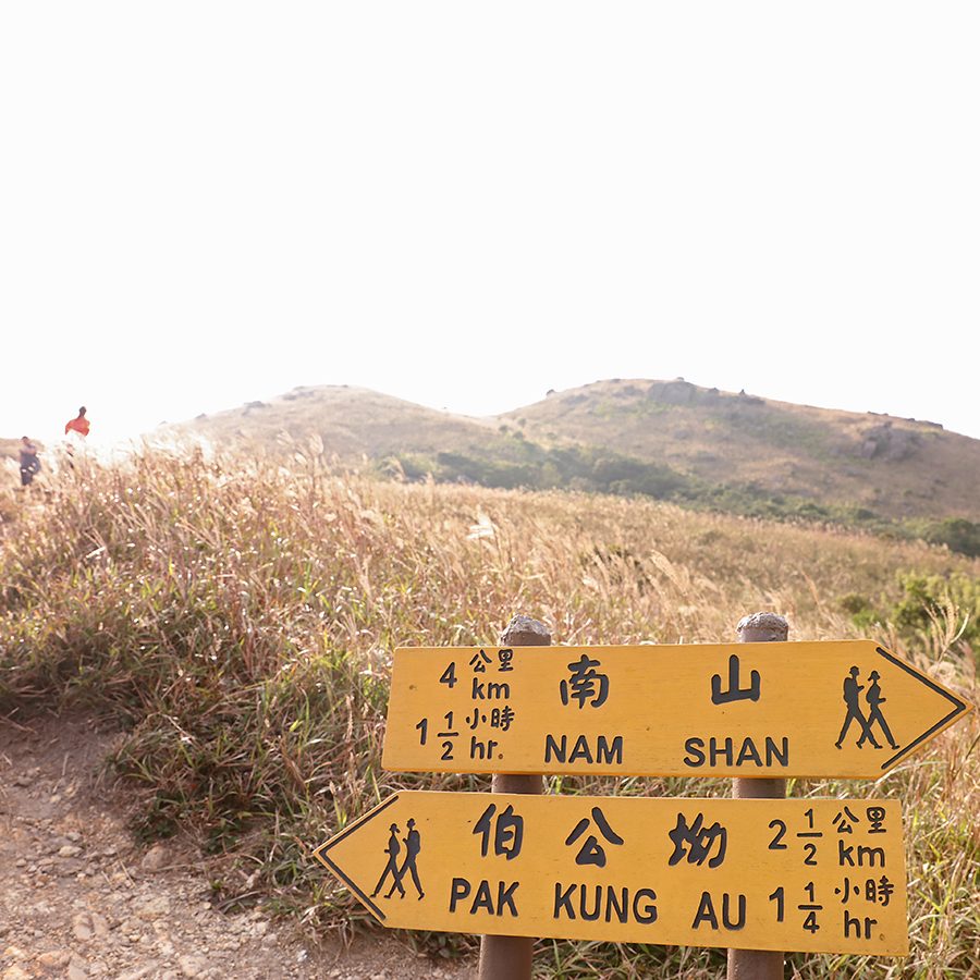
The view: the peaks of Lantau Island and Hong Kong International Airport
The vantage point: Sunset Peak
On the island of Lantau stands Sunset Peak, Hong Kong’s third highest mountain at 869 metres and another considerable effort to climb – but well worth it for its expanses of scenery. A number of mini waterfalls provide welcome natural refreshment along the way, and you’ll also see stone shacks of the Lantau Mountain Camp as you ascend.
Once at the summit, you’ll find yourself above the airplanes descending into the nearby Hong Kong International Airport, while panoramic views include rocky boulders and rustling silvergrass. The ultimate time to get there is just before sunset – be sure to take a torch for the journey back down.
How to get there: take the MTR to Tung Chung (35 minutes from Central) and either walk approximately two kilometres to the start of the trail at Wong Lung Hang, or take any of the many buses along Tung Chung Road to Pak Kung Au, where you can begin the hike that finishes in Mui Wo.
This story was originally published in January 2020 and updated in August 2024.
More inspiration
Hong Kong travel information
- China – the Chinese Mainland, Hong Kong SAR, Macao SAR and Taiwan Region
- Hong Kong SAR - English
- Chinese Mainland (China) - English
- Taiwan, China - English
- 香港特別行政區 - 繁體中文
- 中国內地 - 简体中文
- 中國台灣 - 繁體中文
- Africa
- South Africa - English
- Asia
- Bangladesh - English
- Korea - English
- Singapore - English
- Cambodia - English
- 한국 - 한국어
- Sri Lanka - English
- India - English
- Malaysia - English
- Thailand - English
- Indonesia - English
- Maldives - English
- ประเทศไทย - ภาษาไทย
- Indonesia - Bahasa Indonesia
- Myanmar - English
- Vietnam - English
- Japan - English
- Nepal - English
- Việt Nam - tiếng Việt
- 日本 - 日本語
- Philippines - English
- Australasia
- Australia - English
- New Zealand - English