Since 2016, National Geographic International Photo Contest winner Tugo Cheng has documented Hong Kong’s unique cityscape by drone for his City Patterns series. Here are his top shots.
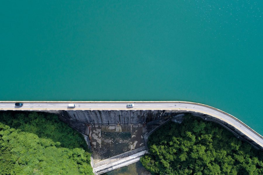
Tai Tam reservoir
Close to Nature
Shot from one of the city’s most popular hiking trails, a narrow stretch of Tai Tam Road sharply divides the above image into two sections – the land and water – creating distinct patches of colours in the frame.
Credit: Tugo C.Y. Cheng
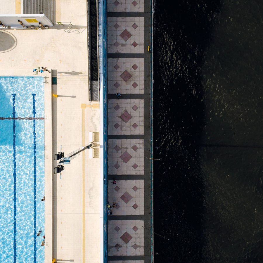
Hung Hom
Take a Dip
Unlike many aerial shots that only showcase the towering cityscape of Hong Kong, Cheng’s City Patterns also puts residents’ daily lives into perspective. In this photo, a lone swimmer is seen cooling himself off in Victoria Harbour, as others swim in the confines of a conventional pool just a few hundred metres from the coastline.

Credit: Tugo C.Y. Cheng
Tuen Mun
Time to Refuel
At eye level, these three fuel storage tanks in Tuen Mun aren’t particularly interesting. But switch to a bird’s eye view, and three huge Chinese characters, the word for ‘fuel’ or ‘oil’, are revealed. The shot was widely circulated in the city when the phrase ‘add oil’ (a Chinese term of encouragement) was added to the Oxford English Dictionary last October.
Credit: Tugo C.Y. Cheng
Credit: Tugo C.Y. Cheng
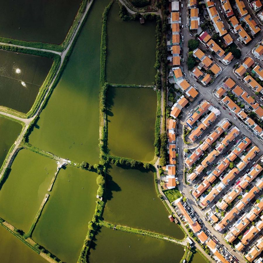
Tseung Kwan O & Yuen Long
Alive or Dead
Hongkongers deal with crowded living conditions – even after death. This pair of photos was shot above a massive residential compound in Yuen Long and above the Tseung Kwan O Chinese Permanent Cemetery: the houses of the living and the dead share more than we’d care to accept.
Credit: Tugo C.Y. Cheng
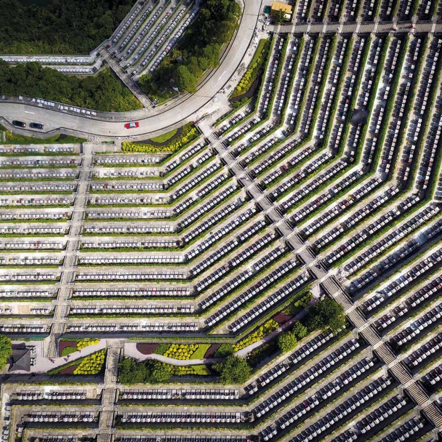
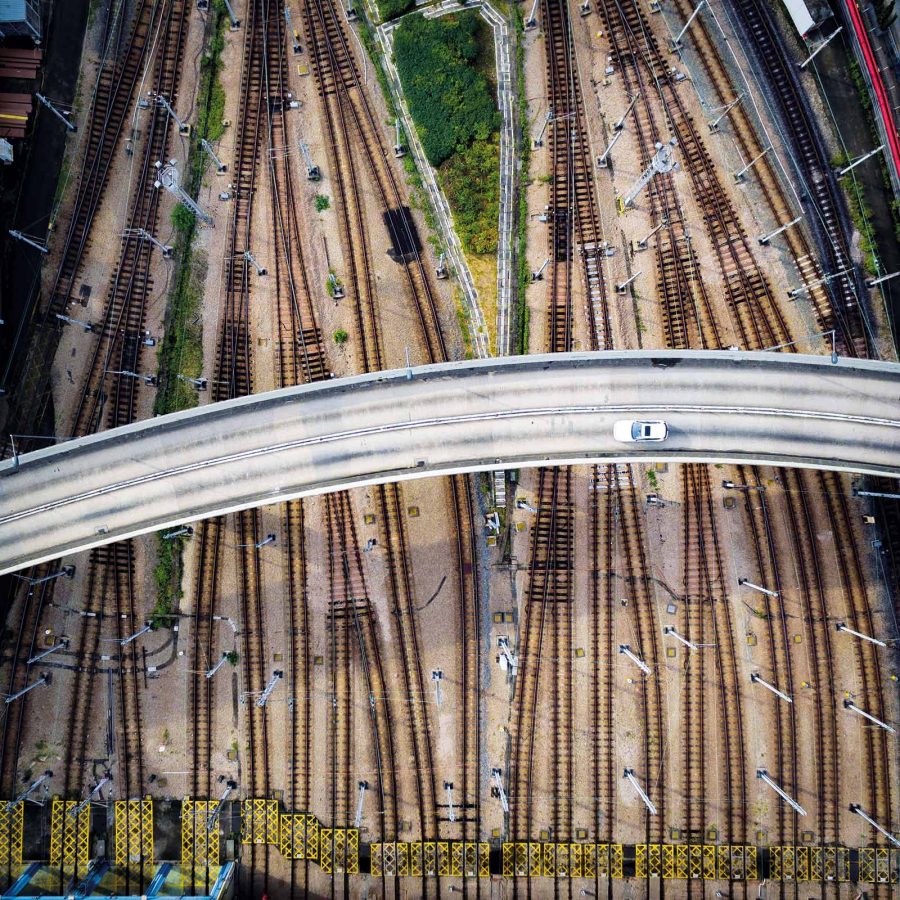
Kowloon Bay
Crossing Paths
This aerial view of the Kowloon Bay MTR Depot highlights Hong Kong’s three-dimensional city planning, in which transport infrastructure is often stacked on multiple levels as the city searches for space.
Hero image: Tugo C.Y. Cheng