


Where to hike in Taipei and feast afterwards

On a clear day’s hike in Taipei, you can gaze out across the beautiful landscape of Taiwan’s northern coast, including the settlements and peaks that stretch out to the East China Sea, states the placard mounted on the summit of Mount Qixing (Seven Stars Peak).
"How many can you identify?" it asks.
Well, none. All I can see is grey mist swirling all around us.
But any disappointment was washed away by my elation at summiting Taiwan’s highest dormant volcano – and by the pumping adrenaline of the past two hours as we ascended the peak, deep in Yangmingshan Park on the northern rim of the Taipei basin.
Mount Qixing is the most arduous hike in Taipei of the three my friend and I challenged ourselves to conquer in a week. We were on a mission to see if we could burn off all the calories we wanted to consume. After all, you can’t really visit this city without dipping into its bountiful food scene: bowls of beef noodles, grilled meats on skewers, bubble tea, rambunctious night markets…
Credit: Tim Pritchard
Luckily, the island of Taiwan is almost 60 per cent forested, with more than 250 mountains over 3,000 metres (plus many smaller ones) and countless hiking trails. Many are easily accessible from Taipei, meaning you can hike in the day and be back in the city in time for a well-earned feast.
Here are the three mountain trails we climbed, from easiest to most ambitious – and suggestions for where to refuel once you’re done.
Credit: Shutterstock
The Four Beasts
Historic shrines and sunset city views
Taipei 101’s elegant, tiered structure, designed to resemble bamboo, is the jewel in the city’s skyline – and the best views of it are from atop the 183-metre-tall Elephant Mountain. It’s one of four peaks (Tiger, Leopard and Lion are the others) along the city’s eastern edge that make up the Si Shou Shan (Four Beasts) hike in Taipei.
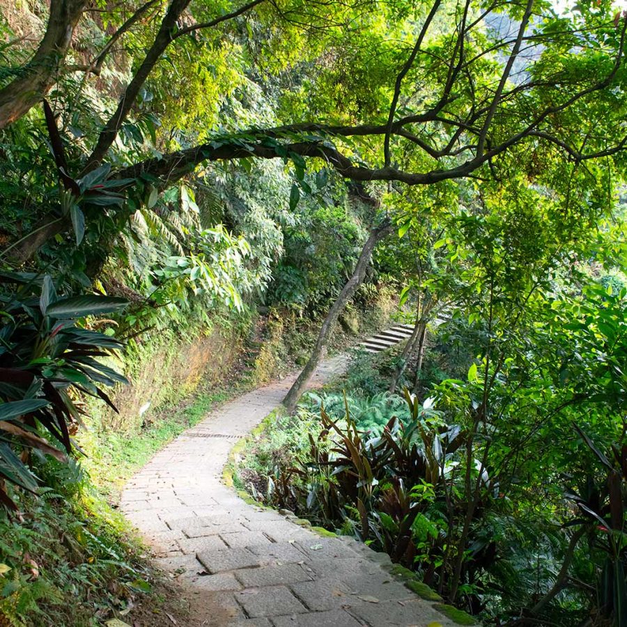
For a leisurely hike, we started at the Si Shou Shan Public Forest entrance, allowing us to take in several of the peaks. With signposts at regular intervals, the well-maintained trail winds past gardens, shrines with statues of deities and up along jungly hillsides. Prepare to stop for multiple photo-ops and panoramic skyline views along the way.

Credit: Ei Katsumata / Alamy Stock Photo
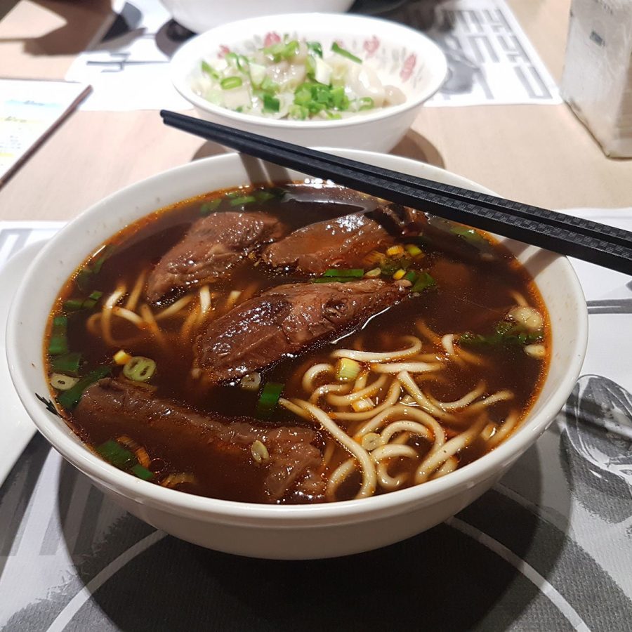
The end of the Elephant Mountain section spits you out back on street level, a 10-minute walk from the subway. In between, you’ll find many restaurants in the alleys and lanes around Zhuangjing Road serving piping-hot bowls of beef noodles – or walk the 15 minutes to Taipei 101 for steaming baskets of Din Tai Fung's xiaolongbao soup dumplings.
How to get there: The nearest MRT station is Hou Shan Pi. The trailhead is 15 minutes’ south, past Yucheng Park, and begins at Si-Shou Shan Public Forest
Time: 2-3 hours
Difficulty: 2/5
Calories burned: 600-900 depending on how many of the Four Beasts you hike
Calories consumed: 530 (beef noodles) / 620 (basket of 10 dumplings)
Credit: Shutterstock
Sandiaoling Waterfalls Trail
Cascading Waterfalls, Forest Bathing and Cats
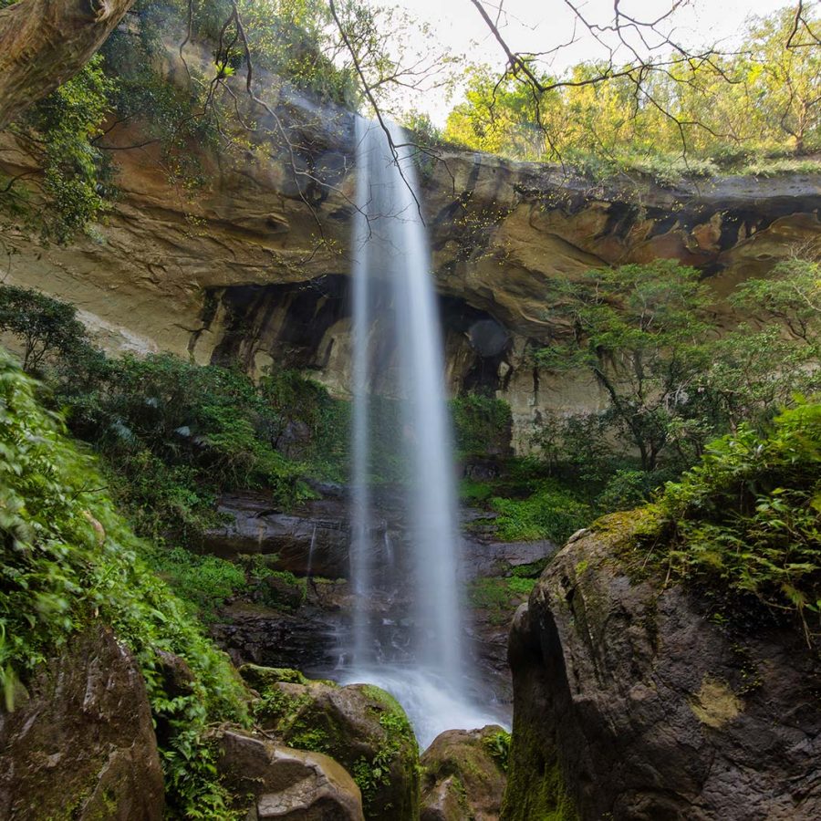
You’ve got to work a bit harder on the Sandiaoling Waterfalls Trail, an hour’s train ride east of Taipei in the rural Ruifang district. The first waterfall, Hegu, is visible only from a distance as you ascend into the wooded hillside. But after a few small rope bridge crossings, you can get up close to the majestic Motian waterfall, which crashes into the rocks below.
Admire the 40-metre-tall spectacle then follow a fiddly path that will take you behind the waterfall for an alternative angle. You’ll have to navigate a vertiginous staircase and a rope ladder towards the third waterfall, Pipadong. (A good pair of hiking shoes is advisable, but you can get away with a comfortable pair of trainers.)
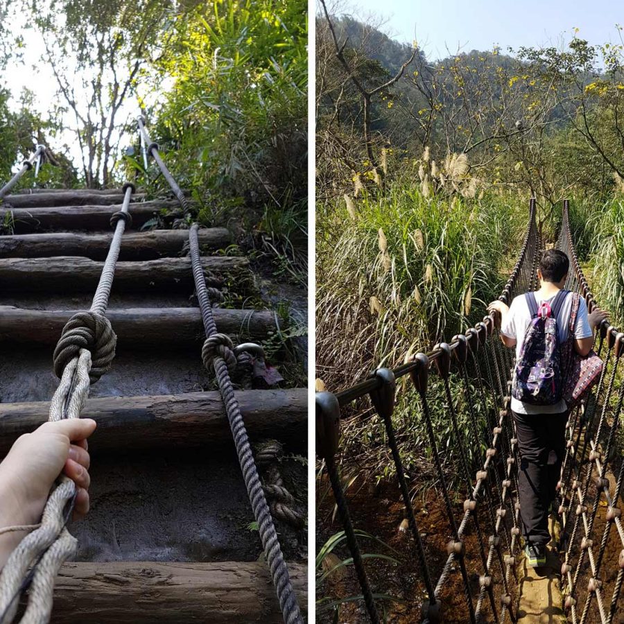
Credit: Tim Pritchard
Most hikers will reach this point within a couple of hours. Some turn back, but we intended to work up an appetite and continued towards Houtong following the Chailiao Trail. This section amounts to Taiwan’s version of "forest bathing", with nothing but the sounds of the forest and our footsteps, and the occasional sight of an abandoned farmhouse, to accompany you.
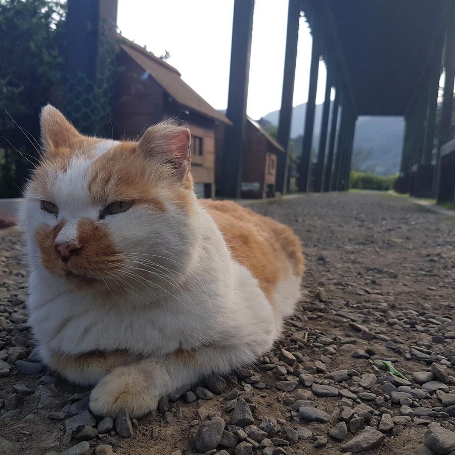
Six kilometres later, we reached Houtong. The old mining town was built by the Japanese during the wartime occupation, but now its chief export is selfies taken with hundreds of stray cats. We poked our heads into the gutted brick buildings that once housed miners and their families and browsed handicraft shops for souvenirs.
Credit: Tim Pritchard
Before catching the train back to the Taipei, treat yourself as we did to bowls of noodles and fish balls, or a few rounds of local craft beer and snacks at a cafe.
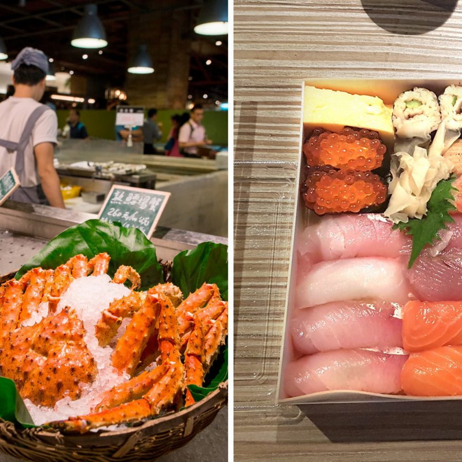
Taiwan is known for its seafood, so it felt appropriate to see what we could find at Addiction Aquatic Development , Taipei’s version of Tokyo’s Tsukiji fish market. This temple to seafood combines a fish market, a supermarket selling fresh seafood bento boxes, sit-down restaurants as well as stand-up sushi counters. A couple of takeaway bento boxes, sushi sets and ice-cold pints of Asahi later, we’d probably undone all our hard work. Worth every calorie though.
Credit: Alamy; Tim Pritchard
How to Get There: From Taipei Main Station, catch the TRA train to Ruifang Station, then switch to the Pingxi railway line. Get off at Sandiaoling Station, follow the tracks towards the tunnel, take the underpass and follow the path beside the railway towards the settlement of Sandiaoling. The trail begins at the entrance of Shuoren Elementary School
Time: 4 hours
Difficulty: 3/5
Calories burned: 1,800 (if you make it to Houtong)
Calories consumed: 800+ (expect to double that if you choose to visit Addiction Aquatic Development…)
Credit: Paul Quayle / Alamy Stock Photo
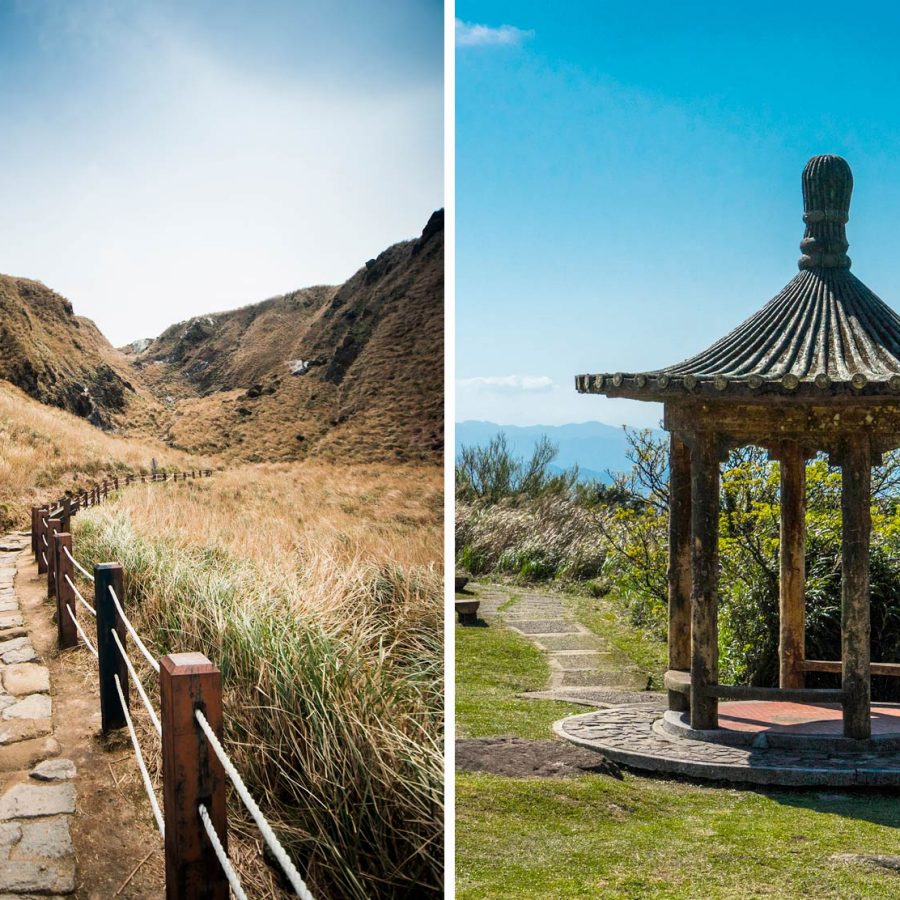
Seven Stars Mountain
Misty mountain hops and night market feasts
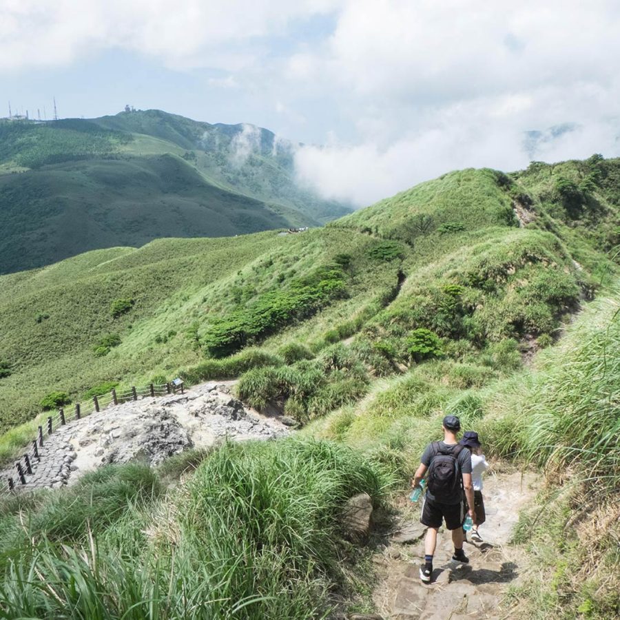
Whether you set out on a sun-kissed summer morning or a drizzly, misty spring day as we did, hiking Seven Stars Mountain ranks among the best Taiwan experiences. You can take several routes; we chose the Miaopu Trail. To reach the main peak requires a few hours of traversing gentle steps, dirt trails and some vertiginous climbs that get your muscles firing on all cylinders.
Keep an eye out for thousands of species of native flowers and birds; rufous-capped babblers and Chinese bamboo partridges tend to plod around in the shrubs or silvergrass of Yangmingshan Park.
Mount Qixing East Peak (1,107 metres) is the trail’s first major milestone, followed shortly after by the main peak (1,120 metres). As the placard said, you should be able to gaze far and wide from the peaks – but even if the weather isn’t on your side, you’ll still enjoy an atmospheric trek that’ll work up a good appetite for dinner.
Credit: Shutterstock
Word of warning: the way down from the summit winds past some sulphur bogs, which might turn a few stomachs, before reaching the Xiaoyoukeng Visitor Centre and the Xiaoguanyin trailhead, where you can hitch a ride back down to the starting point, Yangmingshan bus station.
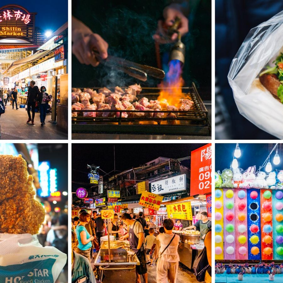
The bus ride back to the city drops you off at Shilin night market, possibly the buzziest and tastiest of the city’s feeding frenzies. Taipei’s night markets are famous for the surfeit of street food stalls that swallow up the warren of streets around temples (they originally sprang up to feed hungry patrons after they’d paid their respects).
It’s fitting that our biggest hike in Taipei was followed by our biggest feast: giant slabs of fried chicken, gua bao (pillowy soft steamed buns filled with braised pork), barbecued meats on sticks, delicate spiced quail eggs, sweet grilled sausages. Foodies and famished hikers won’t leave disappointed.
Credit: Laura Barisonzi; Getty Images
How to Get There: The R5 bus from Jiantan or Shilin MRT stations to Yangmingshan bus station takes around 45 minutes. On the way back, the bus will drop you off close to Shilin night market, which gets going around 6pm
Time: 6 hours
Difficulty: 4/5
Calories Burned: 2,200 calories
Calories Consumed: 1,200+ depending on how much you indulge in Shilin night market
This story was originally published in December 2019 and updated in September 2020
More inspiration
Taipei travel information
- China – the Chinese Mainland, Hong Kong SAR, Macao SAR and Taiwan Region
- Hong Kong SAR - English
- Chinese Mainland (China) - English
- Taiwan, China - English
- 香港特別行政區 - 繁體中文
- 中国內地 - 简体中文
- 中國台灣 - 繁體中文
- Africa
- South Africa - English
- Asia
- Bangladesh - English
- Korea - English
- Singapore - English
- Cambodia - English
- 한국 - 한국어
- Sri Lanka - English
- India - English
- Malaysia - English
- Thailand - English
- Indonesia - English
- Maldives - English
- ประเทศไทย - ภาษาไทย
- Indonesia - Bahasa Indonesia
- Myanmar - English
- Vietnam - English
- Japan - English
- Nepal - English
- Việt Nam - tiếng Việt
- 日本 - 日本語
- Philippines - English
- Australasia
- Australia - English
- New Zealand - English